Les Hauts-Geneveys
| Les Hauts-Geneveys | ||
|---|---|---|
| State : |
|
|
| Canton : |
|
|
| District : | No district division | |
| Municipality : | Val-de-Ruz | |
| Postal code : | 2208 | |
| former BFS no. : | 6481 | |
| Coordinates : | 557 173 / 211151 | |
| Height : | 986 m above sea level M. | |
| Area : | 7.95 km² | |
| Residents: | 921 (December 31, 2012) | |
| Population density : | 116 inhabitants per km² | |
| Website: | www.leshauts-geneveys.ch | |
|
Les Hauts-Geneveys |
||
| map | ||
|
|
||
Les Hauts-Geneveys was a municipality in the Val-de-Ruz district in the canton of Neuchâtel in Switzerland . The community consisted of the districts of Les Hauts-Geneveys and Tête-de-Ran . On January 1, 2013, it merged with the municipalities of Boudevilliers , Cernier , Chézard-Saint-Martin , Coffrane , Dombresson , Engollon , Fenin-Vilars-Saules , Fontainemelon , Fontaines , Les Geneveys-sur-Coffrane , Montmollin , Le Pâquier , Savagnier and Villiers to the new municipality of Val-de-Ruz .
geography
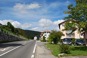
Les Hauts-Geneveys is 986 m above sea level. M. , eight kilometers northwest of the canton capital Neuchâtel (linear distance ). The highest village in the Val de Ruz extends on the eastern slope of the Tête de Ran in the Neuchâtel Jura , in a panoramic position with a view of the Val de Ruz basin , the Swiss plateau and, on a clear day, as far as the Alps .
The area of the 8.0 km² municipal area comprises a small section in the northwest of the syncline of the Val de Ruz. The municipality floor extends to the west over the wooded slope ( Forêt de la Baume ) on the anticline of the Tête de Ran ( 1422 m above sea level ) and the heights of the Derrière Tête de Ran to the west . On the Jura heights there are extensive high pastures with the typical mighty spruce trees , which either stand individually or in groups. In the far west, the area extends into two small evacuation basins on the northeastern edge of the Vallée des Ponts . The highest point of Les Hauts-Geneveys is 1430 m above sea level. M. in the southwest of the Tete-de-Ran chain on the Rochers Bruns . In 1997, 6% of the municipal area was in settlements, 45% in forests and woodland, 48% in agriculture and a little less than 1% was unproductive land.
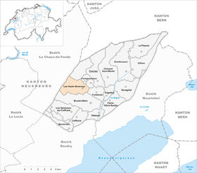
Les Hauts-Geneveys has numerous individual farms on the Jura heights. Neighboring municipalities to Les Hauts-Geneveys are Boudevilliers , Fontaines , Fontainemelon and La Sagne .
population
With 921 inhabitants (as of December 31, 2012) Les Hauts-Geneveys is one of the smaller communities in the canton of Neuchâtel. 92.3% of the residents are French-speaking, 3.5% German-speaking and 1.7% Italian-speaking (as of 2000). The population of Les Hauts-Geneveys has fluctuated between 400 and 600 since 1850, but has increased significantly in recent decades.
economy
For a long time, Les Hauts-Geneveys was mainly an agricultural village, mainly focused on cattle breeding and dairy farming . In the course of the 19th century, some watchmaking companies set up shop . In the last few decades Les Hauts-Geneveys has developed into a residential community. Many workers are commuters and work mainly in Neuchâtel or in La Chaux-de-Fonds . The community is the location of a grain collection point of the Agricultural Cooperative of Val de Ruz and a place for the mentally handicapped.
traffic
The community has good transport links. It is located on the former main road from Neuchâtel over the Vue des Alpes pass to La Chaux-de-Fonds and on the expressway that was opened in 1994 and connects these two cities. It passes under Les Hauts-Geneveys in a tunnel.
On December 1, 1859, the railway line from Neuchâtel to Les Hauts-Geneveys was inaugurated, and on July 15, 1860, the continuation towards La Chaux-de-Fonds was opened. The municipality is connected to Les Geneveys-sur-Coffrane and the other places in the western Val de Ruz by a bus line . From 1903 to 1948, Les Hauts-Geneveys was the starting point for the Les Hauts-Geneveys – Villiers tram , which led via Fontainemelon , Cernier , Chézard-Saint-Martin and Dombresson to Villiers . It was replaced by the Val de Ruz trolleybus , which in turn was replaced by buses in 1984.
tourism
The region around the Vue des Alpes and the Tête de Ran is a popular destination for excursions and a recreational area with restaurants and overnight accommodations. The ski lifts are no longer in operation.
history
The first written mention of the place took place in 1354 under the name Geneveis . For a long time the municipality was called Les Geneveys-sur-Fontaines . The etymology of the name is controversial. While some sources say that emigrants from Geneva settled here at the end of the 13th century , others suggest Geneveys as a derivative of genévriers ( junipers ).
Les Hauts-Geneveys belonged to the Valangin domain , which was partly subordinate to the Counts of Neuchâtel, partly to the Counts of Montbéliard and finally came to Neuchâtel in 1592. From 1648 Neuchâtel was a principality and from 1707 it was linked to the Kingdom of Prussia through personal union. In 1806 the area was ceded to Napoleon I and came to the Swiss Confederation in the course of the Congress of Vienna in 1815 , whereby the kings of Prussia until the Neuchâtel trade in 1857 also remained princes of Neuchâtel.
Attractions
Personalities
The social reformer and economic theorist Silvio Gesell (1862–1930) lived temporarily on his farm in Les Hauts-Geneveys.
Web links
- Official website of the municipality of Les Hauts-Geneveys (French)
- Maurice Evard: Les Hauts-Geneveys. In: Historical Lexicon of Switzerland .


