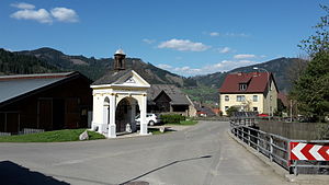
Foirach
|
Foirach ( village ) village Niklasdorf cadastral community Foirach |
||
|---|---|---|
|
|
||
| Basic data | ||
| Pole. District , state | Leoben (LN), Styria | |
| Judicial district | Leoben | |
| Pole. local community | Niklasdorf | |
| Coordinates | 47 ° 23 '54 " N , 15 ° 10' 24" E | |
| height | 538 m above sea level A. | |
| Residents of the village | 2382 (January 1, 2020) | |
| Area d. KG | 2.74 km² | |
| Statistical identification | ||
| Locality code | 15684 | |
| Cadastral parish number | 60305 | |
| Counting district / district | Niklasdorf area (61110 002) | |

|
||
| Source: STAT : index of places ; BEV : GEONAM ; GIS-Stmk | ||
Foirach is a district of the municipality Niklasdorf in Styria . Foirach is located on the Mur and on the S 6, the Semmering expressway .
The village has about 190 inhabitants, many of whom still practice agriculture. There is a former knight's seat in the village.
