Forsyth (Montana)
| Forsyth | |
|---|---|
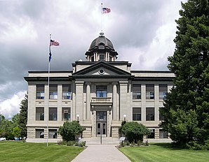
 Downtown Forsyth |
|
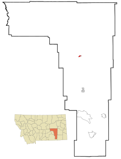
| Location in Montana | |
| Basic data | |
| Foundation : | 1876 |
| State : | United States |
| State : | Montana |
| County : | Rosebud County |
| Coordinates : | 46 ° 16 ′ N , 106 ° 41 ′ W |
| Time zone : | Mountain ( UTC − 7 / −6 ) |
| Residents : | 1,944 (as of: 2000) |
| Population density : | 670.3 inhabitants per km 2 |
| Area : | 2.9 km 2 (approx. 1 mi 2 ) |
| Height : | 769 m |
| Postal code : | 59327 |
| Area code : | +1 406 |
| FIPS : | 30-27700 |
| GNIS ID : | 0771501 |
| Website : | www.forsythmontana.org |
 Rosebud County Courthouse |
|
Forsyth is a city in Rosebud County , Montana , in the United States of America . At the census in 2000 it had 1,944 inhabitants. It is the seat of the county seat of Rosebud County.
history
Forsyth was founded in 1876 as a settlement on the Yellowstone River . It was a berth for paddle steamers and served the United States Army during the Indian Wars.
In 1882 Thomas Alexander founded the city.
In 1894 500 men from the socialist Coxey's Army , inspired by Jacob Coxey and led by William Hogan, rode a train to Washington, DC. They were arrested in Forsyth. Most of Coxey's Army were taken to Helena as prisoners. A United States Air Force base was established in the city in the 1980s .
Namesake
In 1882 the city was named after James William Forsyth (1834-1906). Forsyth was a general responsible for the Wounded Knee massacre .
geography
Forsyth is located at the coordinates 46 ° 16 ' N , 106 ° 41' W .
According to the United States Census Bureau , the city covers an area of 2.9 km² , on which there are no bodies of water.
Demographics
According to the 2000 census, 1944 people lived in the city. These are distributed over a total of 826 households and 525 families. The population density is 676.2 people per km² . The races are graded as follows: 95.42% white; 2.26% Native Americans; 1.23 Latin Americans or Hispanics; 0.82 Asians; 0.21% African American. The rest belong to other minorities or are multiracial.
There are 826 households of which 29.8% have children under the age of 18, 52.7% married couples, 7.4% single women and 36.4% people without a family. People who are older than 65 live in 14.4% of households. The average number of people in a household is 2.28 and in families 2.89.
The age structure of the city is staggered as follows: 25.1% under 18 years; 5.4% between 18 and 24 years of age; 25.2% between 25 and 44 years of age; 27.0% between 45 and 64 years of age; 17.4% over 64 years
The median income per household is $ 33,533 and that of families is $ 44,100. 9.4% of families and 10.5% of the total population live below the poverty line.
Web links
Individual evidence
- ↑ The Apsaalooke (Crow) Scouts . National Park Service. Retrieved November 20, 2009.
- ↑ Forsyth, Montana . Montana: The Magazine of Western History. Retrieved November 20, 2009.
- ↑ The Coxey Brigade Must All Go To Court . Saint Paul Daily Globe. Retrieved November 20, 2009.
- ↑ 22nd Infantry Regiment at Fort Keogh 1888-1896 . Retrieved January 27, 2012.
- ^ To provide for the conveyance of the Radar Bomb Scoring Site, Forsyth, Montana. S 886 . Library of Congress. Retrieved November 20, 2009.
