Frémur (Saint-Briac)
| Frémur | ||
|
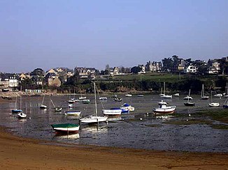
On the Frémur estuary |
||
| Data | ||
| Water code | FR : J1004000 | |
| location | France , Brittany region | |
| River system | Frémur | |
| source | in the municipality of Corseul 48 ° 28 ′ 39 ″ N , 2 ° 6 ′ 27 ″ W |
|
| Source height | approx. 95 m | |
| muzzle | between Lancieux and Saint-Briac-sur-Mer in the English Channel Coordinates: 48 ° 36 ′ 16 ″ N , 2 ° 7 ′ 26 ″ W 48 ° 36 ′ 16 ″ N , 2 ° 7 ′ 26 ″ W |
|
| Mouth height | approx. 7 m | |
| Height difference | approx. 88 m | |
| Bottom slope | approx. 4.2 ‰ | |
| length | 21 km | |
| Reservoirs flowed through | Lac de Frémur | |
| Small towns | Pleurtuit | |
The Frémur is a coastal river in France that runs in the Brittany region . It rises in the municipality of Corseul , drains in an arc from northeast over north to northwest, passes the Dinard-Pleurtuit-Saint-Malo airport and flows into the English Channel after 21 kilometers between Lancieux and Saint-Briac-sur-Mer in an estuary . On its way, the Frémur crosses the Côtes-d'Armor department and, in its lower reaches, forms the border with the neighboring Ille-et-Vilaine department .
Note: Not to be confused with the coastal river of the same name, Frémur , which also flows into the English Channel about 20 kilometers to the west, at Fréhel .
Places on the river
Individual evidence
- ↑ Source geoportail.gouv.fr
- ↑ estuary geoportail.gouv.fr
- ↑ a b The information on the length of the river is based on the information on the Frémur at SANDRE (French), accessed on February 20, 2013, rounded to the nearest kilometer. However, they do not include the estuary section!
