Frankenteich
| Frankenteich sawmill pond |
|||||||||
|---|---|---|---|---|---|---|---|---|---|
| View over the Frankenteich | |||||||||
|
|||||||||
|
|
|||||||||
| Coordinates | 51 ° 35 '58 " N , 11 ° 1' 24" E | ||||||||
| Data on the structure | |||||||||
| Construction time: | 1724, repairs 1970–1973 | ||||||||
| Height above valley floor: | 16 m | ||||||||
| Height above foundation level : | 17 m | ||||||||
| Height of the structure crown: | 434.5 m | ||||||||
| Building volume: | 42 000 m³ | ||||||||
| Crown length: | 150 m | ||||||||
| Crown width: | 4 m | ||||||||
| Slope slope on the air side : | 1: 2 | ||||||||
| Slope slope on the water side : | 1: 2 | ||||||||
| Data on the reservoir | |||||||||
| Altitude (at congestion destination ) | 430.6 m | ||||||||
| Water surface | 7.5 ha | ||||||||
| Total storage space : | 513 000 m³ | ||||||||
| Catchment area | 3.7 km² | ||||||||
| Design flood : | 7.4 m³ / s | ||||||||
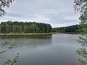
The Frankenteich (also sawmill pond) is an old dam in the Harz Mountains . It was created for mining in 1716 under the direction of mine director Christian Zacharias Koch and is the largest pond in the Lower Harz. Since 1901 it has been serving the drinking water supply of Straßberg . Various source arms of the Rödelbach are dammed . A ditch originally connected the upper Kiliansteich with the Frankenteich. At the foot of the dam, the Stollgraben leads past the nearby Kiliansteich and, like this, is part of the Unterharzer pond and moat system .
The dam , based on clay and quartzite slate, is sealed with an inner seal made of turf sod. The earth dam was repaired in 1973 and not increased. During the repair work, a slot was removed at the bottom outlet in the middle of the dam and rebuilt with a new seal made of clay and new pipelines.
literature
- Dams in Saxony-Anhalt, author college, publisher: Talsperrenmeisterei des Landes Sachsen-Anhalt, 1994

