Knäred
| Knäred | ||||
|
||||
| State : | Sweden | |||
| Province (län): | Hallands Lan | |||
| Historical Province (landskap): | Halland | |||
| Municipality : | Laholm | |||
| Coordinates : | 56 ° 31 ' N , 13 ° 19' E | |||
| SCB code : | 4000 | |||
| Status: | Crime scene | |||
| Residents : | 1211 (December 31, 2015) | |||
| Area : | 2.93 km² | |||
| Population density : | 413 inhabitants / km² | |||
| List of perpetrators in Halland County | ||||
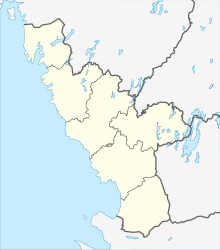
Knäred is a locality ( tätort ) in the Swedish Laholm that the province of Halland belongs. Knäred is about 20 km east of the municipality's main town, the small town of Laholm , and has a population of around 1200 (as of 2015).
The local church, built in 1854, contains the bells and the crucifix of a medieval church that stood on the same spot.
The Lagan River has several major rapids near Knäred with hydroelectric power stations that used to provide electricity to both southern Sweden and the Danish Zealand . At 32 meters, the Karseforsen rapids downstream from the village have the greatest drop.
Peace of Knäred
On January 20, 1613, a peace treaty between Denmark and Sweden was signed in the place, which ended the Kalmark War. Sweden had to pay one million riksdaler - spread over six years - to keep Älvsborg fortress . There is a memorial stone for this peace treaty in the nearby town of Sjöared.
Web links
Individual evidence
- ↑ a b Statistiska centralbyrån : Land area per Tatort, folkmängd and invånare per square kilometer. Vart femte år 1960 - 2015 (database query)
