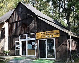
Friedrich Wilhelm Stollen
| Friedrich Wilhelm Stollen | |||
|---|---|---|---|
| General information about the mine | |||
| Rare minerals | Lead ore , nickel ore , calcite | ||
| Information about the mining company | |||
| Start of operation | 1794 | ||
| End of operation | approx. 1969 (shut down 1857 – approx. 1957) |
||
| Funded raw materials | |||
| Degradation of |
Iron ore and copper ore ; later fluorspar |
||
| Greatest depth | 122 m | ||
| Geographical location | |||
| Coordinates | 50 ° 23 '28.8 " N , 11 ° 41' 8.6" E | ||
|
|||
| local community | Lichtenberg | ||
| District ( NUTS3 ) | court | ||
| country | Free State of Bavaria | ||
| Country | Germany | ||
| District | Franconian Forest | ||
The Friedrich-Wilhelm-Stollen is a visitor mine near Lichtenberg in northeast Bavaria .
Surname
The tunnel was named after the Prussian King Friedrich Wilhelm II , who was in power when construction began . The region and the Principality of Bayreuth belonged to Prussia from 1791 to 1806 .
location
The Friedrich-Wilhelm-Stollen is located on the Bavarian State Road 2196 from Lichtenberg to Blankenstein . From the Lichtenberg city limits to the tunnel mouth hole near the Selbitz at the exit of the Höllental , the tunnel runs almost next to the road.
Construction and operation
The tunnel was designed by Alexander von Humboldt in 1793 . At that time, Humboldt was chief miner in nearby Steben (today Bad Steben). It took 38 years until it was completed in 1831. The tunnel reached a length of 975 m.
The tunnel was the most modern mine in the region. It served as a water solution tunnel for draining other mines in the vicinity, especially the Lichtenberger Friedensgrube. Iron and copper ore were mined at the same time . Lead and nickel ores, lime and fluorspar as well as quartz initially remained. In 1857 the mine was closed. About 100 years later, operations were resumed. Fluorspar was mined for a good ten years .
Geotope
The tunnel is designated as Geotope 475G002 by the Bavarian State Office for the Environment . See also the list of geotopes in the district of Hof .
Inn
The colliery has been used as an inn since the mining operations were closed in 1857 . The tunnel mouth hole served the restaurant temporarily as a rock cellar. In addition to the restaurant, there are around 16 beds available for overnight guests.
Visitor mine
The access to the tunnel is west of the inn, the former colliery house. 200 meters of the originally about one kilometer long tunnel are accessible to visitors, after which Verbruch blocked the further course of the tunnel until 2019. After the collapse had been removed and the entire length of the tunnel can be walked on again, the area behind the previous collapse will now also be gradually made accessible to the public. The visitor mine is the responsibility of the North Bavaria Mining Authority, based in Bayreuth. As a reminder of the mining tradition, a mine locomotive with a Hunten is set up as a memorial near the tunnel . The cash register and information center are housed in a barn on the former colliery site. Mineral days with mineral exchanges are held there regularly.
Hiking trails
The tunnel is integrated into the educational trail geology and mining Bad Steben - Mordlau - Krötenmühle - Lichtenberg - Blechschmidtenhammer and an adventure trail through the Höllental . Next to the Humboldthaus , the old mining office , there are traces of mining such as pings and mouth holes on the hiking trails. The area is part of the Franconian Forest / Geopark Schieferland network .
literature
- Otto Knopf : Lexicon Frankenwald . Hof 1993. ISBN 3-929364-08-5
- Leaflet from the Friends of Friedrich-Wilhelm-Stollen
- Barbara Christoph: Museums in Upper Franconia. District of Upper Franconia, Bayreuth 2013, ISBN 978-3-94106-509-3 , p. 178.
Web links
Individual evidence
- ↑ Geotope: Friedrich-Wilhelm-Stollen (accessed on March 22, 2020).
- ↑ http://www.regierung.oberfranken.bayern.de/bergamt_nordbayern/


