Fuxin (Autonomous County)

from Wikipedia, the free encyclopedia
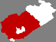
Location of the Fuxin Autonomous Okrug (red) in the area of ​​the city of Fuxin (white)

The Fuxin Autonomous County of the Mongols ( Chinese  阜新 蒙古族 自治县 , Pinyin Fùxīn Měnggǔzú Zìzhìxiàn ) is an autonomous region of the Mongols in the administrative area of ​​the prefecture -level city of Fuxin in the northeast Chinese province of Liaoning . It has an area of ​​6,246 km² and has 732,000 inhabitants (end of 2006).

Administrative structure

At the municipality level, the Fuxin Autonomous District consists of a street district , 20 large municipalities , 15 municipalities and a state farm. These are:

Quarter Road Chengqu (城区街道), seat of the district government;
Greater community Daba (大巴镇);
Daban Municipality (大 板 镇);
Greater Daguben (大 固本 镇);
Greater community Dawujiazi (大五家子镇);
Greater community Dongliang (东梁镇);
Fosi municipality (佛寺 镇);
Greater community Fuxin (阜新镇);
Greater community Furong (富荣镇);
Greater community Fuxingdi (福兴地镇);
Greater community Jianshe (建设镇);
Greater community Jiumiao (旧庙镇);
Greater community Paozi (泡子镇);
Greater community Ping'andi (平安地镇);
Greater community Shala (沙拉镇);
Greater community Shijiazi (十家子镇);
Greater community Wangfu (王府镇);
Wuhuanchi Municipality (务 欢 池 镇);
Greater community Xinmin (新民镇);
Greater community Yimatu (伊玛图镇);
Yusi Municipality (于 寺镇);
Community Bajiazi (八家子乡);
Community Cangtu (苍土乡);
Guohua Township (国 华 乡);
Community Hadahushao (哈达户稍乡);
Community Hongmaozi (红帽子乡);
Community Huashige (化石戈乡);
Community Laohetu (老河土乡);
Community Qijiazi (七家子乡);
Taiping Township (太平乡);
Tayingzi Parish (塔 营 子 乡);
Community Wofenggou (卧凤沟乡);
Community Zhalanyingzi (扎兰营子乡);
Community Zhaoshugou (招束沟乡);
Community Zhizhushan (蜘蛛山乡);
Community Zidutai (紫都台乡);
Paozi State Farm (泡子 农场).

See also

Web links

Coordinates: 42 ° 15 '  N , 122 ° 0'  E