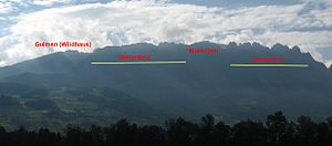
Gätterifirst
| Gätterifirst | ||
|---|---|---|
|
Gätterifirst left center, to the right Mutschen , Chrüzberg , Saxer Lücke . |
||
| height | 2099 m above sea level M. | |
| location | Gams , Canton of St. Gallen , Switzerland | |
| Mountains | Alpstein | |
| Coordinates | 748 537 / 233019 | |
|
|
||
| rock | Schrattenkalk | |
The Gätterifirst is a summit ridge in the Swiss Alpstein , high above Gams in the St. Gallen Rhine Valley with a maximum altitude of 2099 m above sea level. M.
The Gätterifirst forms the western end of the southernmost Alpstein chain , which includes the following from Fänerenspitz to Gulmen : Kamor , Hoher Kasten , Stauberen , Hochhus , Saxer Lücke , Chrüzberg , Mutschen , Gätterifirst (from north to south). On the 1.7 km long section from Wildhauser Gulmen to the small road junction in front of the Mutschen 6 highlights from the Topography listed, but which remain nameless. The highest point in 2099 is right next to the Mutschen and, at 47 meters above the path crossing at 2048 m, does not reach much more than the minimum for a secondary peak . On the other hand, the ridge is extremely impressive and not accessible to hikers; There are some difficult climbing routes on the Gätterifirst.

