Saxer gap
| Saxer gap | |||
|---|---|---|---|
|
Saxer gap seen in the fault line from the Bogarten gap. Above the Bollenwees forest level |
|||
| Compass direction | north | south | |
| Pass height | 1649 m above sea level M. | ||
| Canton | Appenzell Innerrhoden | Canton of St. Gallen | |
| Watershed | Samtiser Bach | Rhine | |
| Valley locations | Rute | Sax | |
| expansion | Mule track | ||
| Mountains | Alpstein | ||
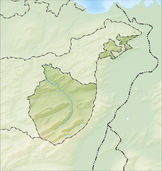
| Map (Appenzell Innerrhoden) | |||
|
|
|||
| Coordinates | 750 347 / 234833 | ||
The Saxer Lücke is 1649 m above sea level. M. high pass crossing in Alpstein , in Switzerland between the cantons of St. Gallen and Appenzell Innerrhoden . It forms a north-south connection between the municipality of Sennwald , located in the St. Gallen Rhine Valley , and the Alpstein (municipality of Rüte ). The top of the pass is on the ridge between Hüser ( 1951 m ) in the northeast and Chrüzberg ( 2065 m ) in the southwest.
Mule track
The area around the Saxer Lücke is a popular hiking area. The mule track over the pass starts at around 480 m in Sax in the St. Gallen Rhine Valley and leads steeply to 1649 m . The short descent leads to the Bollenwees guest house on Lake Fälensee . Continue via the Sämtisersee to Brülisau .
Another path leads over a long ridge from the Hohe Kasten past the Staubernkanzel to the Saxer Lücke and on over the Mutschensattel to Wildhaus in Toggenburg .
In order to hike through the entire Sax-Schwendi break in a south-north direction, one briefly descends from the Bollenwees on a mule track and then steeply up to the Bogartenlücke ( 1730 m ). From here you can descend directly to Wasserauen or Seealpsee .
geology
The entire Alpstein is criss-crossed by a multitude of transverse breaks. The Saxerlücke is part of the most striking fault in the Alpstein, the Sax-Schwende-Bruch . The eastern part of the Alpstein has sunk here and shifted to the north about 1000 meters. The subsidence is related to the Rheintalgraben , a piece of sunken earth's crust .
Web links
- Interactive spherical panorama from the Saxerlücke

