Göksu (Mediterranean)
|
Göksu Coxon, Saleph upper course: Gökçay ancient names: Καλύκαδνος ( Kalykadnos ), Calycadnus |
||
| Data | ||
| location | Karaman , Konya , Mersin ( Turkey ) | |
| River system | Göksu | |
| Union of several streams | near Dedemli ( Bozkır District ) 37 ° 1 ′ 49 ″ N , 32 ° 19 ′ 45 ″ E |
|
| muzzle | about 16 km southeast of Silifke in the Mediterranean Coordinates: 36 ° 17 '54 " N , 34 ° 2' 53" E 36 ° 17 '54 " N , 34 ° 2' 53" E |
|
| Mouth height |
0 m
|
|
| length | 260 km | |
| Right tributaries | Balcılar Çayı, Ermenek Çayı | |
| Reservoirs flowed through |
Bozkır Dam , Bağbaşı Dam |
|
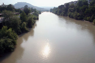
The Göksu ( Turkish "blue water", also Güksu Nehri ; Coxon , Kalykadnos , Saleph ) located in western Cilicia is a river in southern Turkey that flows through the provinces of Konya , Karaman and Mersin . Its ancient Greek name was Καλύκαδνος ( Kalykadnos ), Latinized to Calycadnus .
The river is 260 kilometers long. The upper course is also called Gökçay ("Blue River"). The main tributary is the Ermenek Çayı (sometimes referred to as the second source river). Both rivers arise in the Geyik-Dağları ("Deer Mountains") in the Taurus Mountains between Gündoğmuş (Antalya Province, approx. 50 km north of Alanya ) and Hadım (Konya Province). They unite south of Mut to the (actual) Göksu, which later flows into the Mediterranean between Taşucu and Silifke .
In Ermenek was 2009 ermenek dam on the same river, a tributary of the Göksu completed. The Göksu is also to be dammed by the Kayraktepe dam . The two dams Bozkır and Bağbaşı are located on the upper reaches . There are plans to divert the river water in the headwaters to the north for irrigation purposes.
The Göksu delta with the Akgöl (“White Sea”) and the Paradeniz lagoon (“Money Sea”) is one of the most important breeding and resting areas for birds in the Middle East ; over 300 species of birds have been observed here. Flamingos , herons , bee-eaters , kingfishers , black-headed gulls and nightingales breed here . The endangered sea turtle Caretta caretta and the blue crab ( Callinectes sapidus ) lay their eggs here. It is to be expected that the dam construction will lead to a reduction in size and salinization of the delta.
Emperor Friedrich Barbarossa drowned in 1190 on the Third Crusade near the city of Seleucia in Göksu, which was then called Saleph and was located in the Armenian-Cilician principality allied with Friedrich .
Already in Hittite and later in Roman times, the valley of the Göksu was followed by an army road that connected Lycaonia around Konya with the Mediterranean Sea and thus with the sea route to Cyprus. Initially following the river, due to the narrowness of the river valley, it dodged further south into the slopes, where some of the ancient pavement can still be seen today. In the village of Keben, about 20 kilometers northwest of Silifke, the Hittite rock relief of Keben lies above the ancient road .
Web links
Individual evidence
- ↑ Horst Ehringhaus : Gods, rulers, inscriptions. The rock reliefs of the Hittite Empire in Turkey. Zabern, Mainz 2005, ISBN 3-8053-3469-9 , pp. 112-118.
