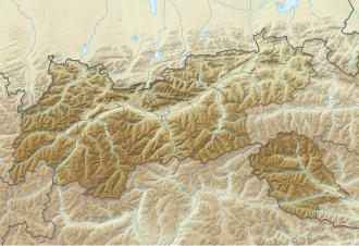
Gaichtpass
| Gaichtpass ( valley pass ) |
|||
|---|---|---|---|
| Compass direction | North | south | |
| height | 1093 m above sea level A. | ||
| state | Tyrol , Austria | ||
| Waters | Weissenbach | ||
| Valley locations | Nesselwängle | Weissenbach | |
| expansion | Tannheimer Strasse B199 | ||
| Map (Tyrol) | |||
|
|
|||
| Coordinates | 47 ° 27 '11 " N , 10 ° 37' 27" E | ||
The Gaichtpass or Gachtpass is 1093 m above sea level. A. high valley pass in the state of Tyrol in Austria .
It connects the Lech Valley near Gaicht with the Tannheim Valley near Nesselwängle . Tannheimer Straße B199 runs over the Gaichtpass from Weißenbach past the Haldensee and via Tannheim to the Oberjochpass in Germany ; the continuation there to Bad Hindelang is the B 308 .
The actual pass height with the watershed between the Lech and its second largest tributary, the Vils, is located between Nesselwängle and the Haldensee at an altitude of around 1150 m ⊙ .
history
Up until the sixth century, the Gaichtpass was used by the Romans as a connection to the Brigantium garrison ( Bregenz ); in the Middle Ages , the path became an important trade route as a mule track , primarily used to transport salt and wine. In the village of Gaicht there is still a salt barn that dates back to the 12th century.
The mule track was expanded into a road in 1550, followed by a road block with a fort that blocked Austria from the Allgäu Hindelanger valley. The fort was expanded in the 17th century and reinforced in 1744. In 1782, Emperor Joseph II ordered the sale of all Tyrolean fortifications except for Kufstein , the fortress was abandoned and the guard house was auctioned. During the Napoleonic Wars , the fortress was restored in 1796. It burned down in the middle of the 18th century, today only a few remains of the wall are preserved.
The old route, which today can only be used as a path or path , initially led along the valley floor and only in the northern valley into the mountain flank. The road only offered space for one draft horse, up to three horses were harnessed one behind the other. In 1661, 15,850 barrels of salt were shipped over the Gaichtpass.
At the beginning of the twentieth century, the route was relocated and a road was built that bypasses the gorge-like Weißenbachtal in the northeastern valley flank about 150 m above the valley floor. In 1957 the street was expanded again.
The Gemstalbrücke, built in 1912, was blown up together with the Lechbrücke in Lechaschau on April 29, 1945 by the retreating Wehrmacht. In 1979 the new bridge was completed.
Web links
- The ultimate tobogganing fun, the old Gaichtpass (Gachtpass). In: Allgäu excursions. February 7, 2005, accessed March 31, 2010 (picture collection).


