Gajówka
| Gajówka | ||
|---|---|---|

|
|
|
| Basic data | ||
| State : | Poland | |
| Voivodeship : | Lower Silesia | |
| Powiat : | Lwówecki | |
| Gmina : | Mirsk | |
| Geographic location : | 50 ° 58 ' N , 15 ° 27' E | |
| Residents : | 122 (2009) | |
| Postal code : | 59-624 | |
| Telephone code : | (+48) (+48) 75 | |
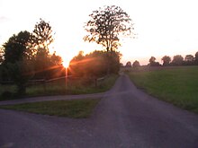
Gajówka (German: Hayne ) is a village in the urban and rural municipality of Mirsk ( Friedeberg am Queis ) in the powiat Lwówecki in the Lower Silesian Voivodeship in south-western Poland . It is located about one kilometer northeast of Rębiszów ( Rabishau ) in the foothills of the Jizera Mountains on the Raczyna ( Fugue ) and consists of 122 inhabitants.
history
The area around Hayne originally belonged to Bohemia with the Queiskreis . Since it lies to the right of the Queis , it was counted as part of the Duchy of Schweidnitz-Jauer from 1346 , which was a Bohemian hereditary principality from 1368. In the first half of the 17th century Hayne was settled with religious refugees from Bohemia and Silesia .
After the First Silesian War in 1742 it fell to Prussia . In 1816 it was incorporated into the Löwenberg district in the province of Silesia . From 1874 the rural community Hayne belonged to the Rabishau district . In 1933 Hayne had 300 residents, in 1939 there were 283.
As a result of the Second World War, Hayne fell with most of Silesia to Poland in 1945 and was renamed Gajówka . Unless they had fled before, the German population was expelled in 1945/46 . Many former residents of Hayne found a new home in Holzminden .
From 1975 to 1998 Gajówka was part of the Jelenia Góra Voivodeship .
Web links
Individual evidence
- ↑ Polish National Statistics Office (2009), query on February 4, 2017
- ↑ Religious refugees
- ^ Rabishau district
- ↑ Inhabitants 1933 and 1939
- ↑ without author: Rabishau Bote from the Queistale. February 1962, p. 10

