Gamskarspitze (Rosslochkamm)
| Gamskarspitze | ||
|---|---|---|
|
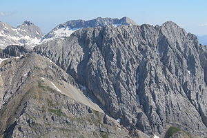
Gamskarspitze from the Speckkarspitze , the summit is slightly to the left of the summit of the Grubenkarspitze behind it (the slightly higher summit on the right is the Brantlspitze). The ascent runs from the meadow in the mountain pines in the lower left corner of the picture towards the ridge, then right through the shallow hollow below the ridge towards the summit, finally in rocks on the ridge |
||
| height | 2601 m above sea level A. | |
| location | Tyrol ( Austria ) | |
| Mountains | Hinterautal-Vomper chain , Karwendel | |
| Coordinates | 47 ° 21 '47 " N , 11 ° 30' 9" E | |
|
|
||
| rock | Wetterstein lime | |
| Age of the rock | Middle and Upper Triassic | |
| First ascent | August 17, 1870 by Hermann von Barth | |
| Normal way | pathless, passages I. | |
|
Gamskarspitze (zoomed in) |
||
The Gamskarspitze ( 2601 m above sea level ) is a little prominent peak in the Rosslochkamm north of the Hallerangeralm ( 1774 m above sea level ) in the Karwendel in Tyrol .
There is no path to the Gamskarspitze, so it is rarely climbed. From the Hallerangeralm it can be reached without a path, but relatively easily with point I in the summit area (2–3 hours from the Hallerangeralm, tracks and individual stone almonds available).
literature
- Walter Klier : Alpine Club Guide Karwendel alpin , 15th edition, 2005, Bergverlag Rudolf Rother, Munich ISBN 3-7633-1121-1


