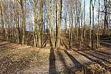
Garching harbor
As Garching harbor an artificial will dock referred to the 1689 with the Schleißheimer channel on the territory of the present municipality of Garching near Munich has been created. It served as a loading point for building materials for the Schleissheim palace complex . Today the pool fell dry, but clearly visible in the area.
description
The Schleissheim Canal is part of the north Munich canal system , which goes back largely to Elector Maximilian II Emanuel . It was laid out by court architect Enrico Zuccalli to supply Lustheim Palace and the planned Schleissheim Palace with water from the Isar . Only the slight difference in height of the Munich gravel plain between the Isar outlet at Großlappen (491.3 m above sea level) and the construction site for Schleißheim Palace (484.6 m above sea level) could be used.
The beginning of the canal was laid parallel to the Isar, but with a smaller gradient, so that it ran between several meters of towering dams. Near Dirnismaning , today the southernmost district of Garching, the Schleissheim Canal bends at an angle of about 90 degrees and diverted the water to the north-west to the castles. The harbor basin was built at this knee of the canal, on which an overflow connection to Garching Mühlbach was created. The basin was also surrounded by dams, the remains of which can still be seen today.
The port was used to load building materials that were needed for the construction of the Schleissheim palace complex. Rafts brought wood , nails , tuff and limestone down the Isar . Clay pits near Ismaning made the bricks for the buildings. From a raft landing on the Isar, which was built south of Garching at the nearest point on the river bank, the materials were brought on barrows to the Garching harbor, located about 1 kilometer west of the Isar. To do this, a small bridge had to be built over the Garching Mühlbach. At the port, the material was loaded onto flat barges, with which it was transported on to the construction site of the palace complex. After the completion of the New Palace in Schleissheim, the harbor basin lost its importance and was abandoned. The canals were used for boat trips to entertain the courtly society until King Ludwig I cut the funds for the maintenance of the boat fleet in 1846.
As part of the Schleissheim Canal, the Garching harbor basin is a listed building as a ground monument.
literature
- Always along the canal. In: Süddeutsche Zeitung , February 19, 2016
Individual evidence
- ↑ Michael Müller: 1100 years of Garching history . In: Helmuth Kammerer, Oliver Hochkeppel (Hrsg.): Our Garching - City Chronicle 1100 years of living history. Volk Verlag, 2015, pp. 27–65, 41
- ↑ a b Christoph Marquart: Garching waters . In: Helmuth Kammerer, Oliver Hochkeppel (Hrsg.): Our Garching - City Chronicle 1100 years of living history. Volk Verlag, 2015, pp. 503-511, 509
- ↑ Historical map. In: BayernAtlas . Retrieved October 17, 2017 .
- ↑ Map with terrain profile. In: BayernAtlas. Retrieved October 18, 2017 .
- ^ Georg Paula , Timm Weski: District of Munich (= Bavarian State Office for the Preservation of Monuments [Hrsg.]: Monuments in Bavaria . Volume I.17 ). Karl M. Lipp Verlag, Munich 1997, ISBN 3-87490-576-4 , p. 2-3 .
Coordinates: 48 ° 14 '5.59 " N , 11 ° 38' 56.35" E

