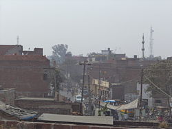
Gauriganj
| Gauriganj गौरीगंज |
||
|---|---|---|
|
|
||
| State : |
|
|
| State : | Uttar Pradesh | |
| District : | Amethi | |
| Sub-district : | Gauriganj | |
| Location : | 26 ° 12 ′ N , 81 ° 41 ′ E | |
| Height : | 109 m | |
Gauriganj ( Hindi : गौरीगंज Gaurīgañj [ ˈɡɔːriːɡʌndʒ ]) is a place in the Indian state of Uttar Pradesh . It is located some 110 kilometers northwest of Prayagraj and 115 kilometers southeast of Lucknow in the region Awadh (Oudh) in Central Uttar Pradesh. The next largest city is Amethi 15 kilometers east. Gauriganj is the administrative center of Amethi District (formerly Chhatrapati Shahuji Maharaj Nagar ). Gauriganj is connected to the railway network via the railway line from Lucknow via Raebareli to Varanasi .
Web links
Commons : Gauriganj - collection of images, videos and audio files
Individual evidence
- ^ The Hindu, July 1, 2010: "Uttar Pradesh gets one more district". ( Memento of the original from October 20, 2012 in the Internet Archive ) Info: The archive link was inserted automatically and has not yet been checked. Please check the original and archive link according to the instructions and then remove this notice.

