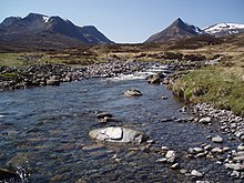
Geal-Chàrn (Ben Alder)
| Geal-Chàrn | ||
|---|---|---|
|
In the foreground the prominent pre-summit of Sgòr Iutharn , behind it the broad summit plateau of Geal-Chàrn |
||
| height | 1132 m ASL | |
| location | Highlands , Scotland | |
| Mountains | Grampian Mountains | |
| Notch height | 410 m | |
| Coordinates | 56 ° 50 '16 " N , 4 ° 30' 35" W | |
|
|
||
| rock | Quartzite | |
The Geal-Chàrn is a Munro and Marilyn classified, 1132 meter high mountain in Scotland . Its Gaelic name can be roughly translated as White Mountain .
It is located in the Council Area Highland in the Grampian Mountains east of Fort William between Loch Ossian and Loch Ericht as part of a mountain range with a total of four Munros and various other peaks, running roughly from southwest to northeast. The mountain range is separated from the broad Ben Alder massif to the southeast by the broad Bealach Dubh , which is up to 722 meters above sea level .


The Geal-Chàrn has a wide and flat, approximately one square kilometer summit plateau with a total of three flat, less prominent peaks, the highest of which is in the west of the plateau and is marked by a cairn . The plateau descends on almost all sides with steep, partly rock-interspersed walls. To the west-south-west, a narrow ridge that remains at a height of over 1000 meters provides the transition to the neighboring, 1116 meter high Aonach Beag . To the northeast, a rocky ridge descends to the 925 meter high pre-summit Diollaid a 'Chairn , through which there is a transition to the Càrn Dearg . To the north runs a short ridge, the Sròn Gharbh , which slopes down to about 800 meters , to the south a short and wide ridge that ends in the rocks of the pre-summit Sron Ruadh . Most noticeable is the one that adjoins it to the east and is separated from the summit plateau by a flat depression , 1028 meter high and rocky pre-summit Sgòr Iutharn . With a steeply sloping north wall, together with the ridge to Diollaid a 'Chairn, this encloses the hole at Sgòir , which is about 700 meters above sea level , to the east it falls with the striking Lancet Edge , a steep rock ridge, visible from afar from the northeast into the valley of the at Allt a 'Bhealaich Dhuibh , which rises from Bealach Dubh .
Due to its location in uninhabited mountainous areas far away from public roads, ascent of the Geal-Chàrn is only possible with a bivouac and long hikes or with the use of mountain bikes . Many Munro excavators climb the four peaks of the mountain range as part of a traverse along the main ridge, beginning either with the Càrn Dearg in the northeast or the Beinn Eibhinn in the southwest. The Geal-Chàrn is then reached via the main ridge. It can also be climbed directly from Bealach Dubh via its steep southern slopes. The climbing tour over the Lancet Edge is more demanding and sometimes exposed . The starting point for all variants is either Dalwhinnie in the northeast or Corrour Station in the southwest, both over 16 kilometers from Geal-Chàrn. Culra Bothy, the only possible overnight stay in a long distance without using a tent , has been closed since 2015 due to asbestos exposure .
Web links
- The Geal-Chàrn on munromagic.com (English)
- The Geal Charn-on walkhighlands.co.uk (English)
- Hill Bagging - the online version of the Database of British and Irish Hills: Geal-Chàrn (English)
Individual evidence
- ↑ Geal-Chàrn on www.munromagic.com , accessed on July 3, 2020
- ↑ Mountain Bothies Association: Culra , accessed on July 5, 2020

