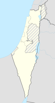
Gedera
| Gedera | ||
|---|---|---|

|
||
| Basic data | ||
| hebrew : | גְּדֵרָה | |
| State : |
|
|
| District : | Central | |
| Founded : | 1884 | |
| Coordinates : | 31 ° 49 ' N , 34 ° 47' E | |
| Height : | 57 m | |
| Area : | 11.492 km² | |
| Residents : | 28.092 (as of: 2018) | |
| Population density : | 2,444 inhabitants per km² | |
| Community code : | 2550 | |
| Time zone : | UTC + 2 | |
| Community type: | Local association | |
|
|
||
Gedera ( Hebrew גדרה, Modern Hebrew pronunciation [ geˈdeʀa ]; German "hurdle") is a place in the tribal area of Judah according to Jos 15.36 EU . Gedera - for a time also known as Katra - is an agricultural colony founded by Bilu pioneers in Palestine in 1884 in the southern part of the coastal plain ("Philistine Land"), roughly in the area of the old Gedera of the Hasmonean era.
As a result, supported for a long time by Baron Rothschild and the Chowewe Zion , it developed into a city with (2018) 28,092 inhabitants.
The recreational and lung sanatorium located there became important.
Gedera is now part of the Central District of Israel .
Personalities
- Gila Gamliel (* 1974), politician
- Wolfgang von Weisl (1896–1974), Zionist journalist
Web links
Commons : Gedera - collection of images, videos and audio files
- City website (Hebrew)
Individual evidence
- ↑ אוכלוסייה ביישובים 2018 (population of the settlements 2018). (XLSX; 0.13 MB) Israel Central Bureau of Statistics , August 25, 2019, accessed May 11, 2020 .
- ↑ Shmuel Bolozky: Remarks on Rhythmic Stress in Modern Hebrew . In: Journal of Linguistics 18.2 (September 1982), pp. 275-289, here p. 286.
- ↑ More detailed explanations in: Wolfgang Scheel: Lexicon of biblical place names in modern Israel . 3. Edition. Hammerbrücke 2003, ISBN 3-933750-32-6 , p. 89 f.
- ↑ אוכלוסייה ביישובים 2018 (population of the settlements 2018). (XLSX; 0.13 MB) Israel Central Bureau of Statistics , August 25, 2019, accessed May 11, 2020 .
