
Geelong Ring Road
| Geelong Ring Road | |
|---|---|

|
|
| map | |
 |
|
| Basic data | |
| Operator: | VicRoads |
| Start of the street: |
Corio ( VIC ) ( 38 ° 3 ′ S , 144 ° 23 ′ E ) |
| End of street: |
Waurn Ponds ( VIC ) ( 38 ° 13 ′ S , 144 ° 15 ′ E ) |
| Overall length: | 25 km |
|
States : |
|
 |
|
The Geelong Ring Road (formerly Geelong Bypass or Geelong Outer Freeway ) is a bypass in Geelong in the south of the Australian state of Victoria . It connects the Princes Freeway in Corio with the Princes Highway in Waurn Ponds . The Midland Highway and the Hamilton Highway are also connected.
Sections 1 and 2 opened on December 14, 2008 and section 3 on June 14, 2009. Section 4 to bypass the traffic lights at the south end of Geelong Ring Road is currently under construction, with section 4A to Anglesea Road already completed .
history
The first plans to build a bypass for Geelong go back to a report by the Geelong Regional Commission dated March 7, 1969. He mentioned that the construction of the Geelong Ring Road could be delayed for up to 15 years.
In 1972 a number of proposals were made, one for a freeway through Geelong West and another for upgrading Aberdeen Street with the acquisition of 99 private properties. Both proposals were dropped due to protests from local residents. In 1979, a Melbourne company carried out acoustic tests in Wandana Heights that looked at the effects of a freeway. The route was established in 1979 and appeared on the Melway city map for several years .
The increase in traffic led to the expansion of Latrobe Terrace in early 1989 and the construction of the James Harrison Bridge over the Barwon River .
Construction stages
On February 20, 2007 the project was renamed 'Geelong Ring Road'.
Construction of the bypass began in early 2006 with the freeway section to Waurn Ponds , which should be completed in 2009. The first three construction phases were initially jointly financed by the state government of Victoria and the Australian federal government with AU- $ 384 million.
The Geelong Ring Road (Freeway) was divided into three construction phases, all of which began in 2006:
- Stage 1: From Princes Freeway in Corio to Midland Highway in Bell Post Hill .
- Construction phase 2: From the Midland Highway in Hamlyn Heights to the Hamilton Highway in Fyansford .
- Phase 3: From the Hamilton Highway in Fyansford to the Princes Highway in Waurn Ponds . The route of construction phase 3 was discussed for a long time on site. It was finally determined on July 7, 2006 and construction began in September 2007. The Geelong Ring Road is free to use.
-
Construction phase 4 was divided into three subsections:
- Section 4A: From Geelong Ring Road to Anglesea Road
- Section 4B: From Anglesea Road to Princes Highway
- Construction phase 4C: Connection of the Surf Coast Highway
In October 2007, during the federal election campaign, the Labor Party pledged an additional AU $ 107.5 million for the fourth section of the road. That was AU $ 45 million for Section 4B on top of the AU $ 62.5 million for Section 4A that was committed in September 2007. In May 2008, Sections 4A and 4B were approved, with Victoria Prime Minister John Brumby pledging AU $ 65 million for Section 4B in addition to AU $ 63 million for Section 4A.
Gallery images

Geelong Ring Road under construction (2007) in Bell Post Hill

Lewis Bandt Bridge under construction over the Moorabool River (2007)

Lewis Bandt Bridge under construction (2007)

Looking south from the Hamilton Highway to Section 3, the bridge over the Barwon River and the incline over the Barrabool Hills
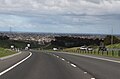
At the Barrabool Road exit. Looking south towards Waurn Ponds


Crossings and junctions
|
Geelong Ring Road |
|||
| Connections to the north | Distance to Melbourne (km) |
Distance to Colac (km) |
Connections to the south |
|
End of Geelong Ring Road and continue as Princes Freeway West to Melbourne |
64 | 92 |
Beginning of Geelong Ring Road from Princes Freeway West |
| Bacchus Marsh, Corio Bacchus Marsh Road |
66 | 90 | Corio, Bacchus Marsh Bacchus Marsh Road |
| Anakie, Norlane Anakie Road |
70 | 86 | Norlane, Anakie Anakie Road |
| RAILWAY LINE TO SOUTH AUSTRALIA | 72 | 84 | RAILWAY LINE TO SOUTH AUSTRALIA |
|
Ballarat , Geelong Midland Highway |
74 | 82 |
Geelong , Ballarat Midland Highway |
|
Hamilton , Geelong Hamilton Highway |
79 | 77 |
Geelong , Hamilton Hamilton Highway |
| Ceres, Belmont Barrabool Road |
82 | 74 | Belmont, Ceres Barrabool Road |
|
Beginning of Geelong Ring Road |
89 | 67 |
End of Geelong Ring Road |
|
Princes Highway to Geelong (8 km) and Great Ocean Road (19 km) via Torquay (17 km) Rossack Drive Princes Highway to Great Ocean Road (19 km) via Anglesea (29 km); Colac (67 km), Warrnambool (181 km) |
|||
Web links
- Information about construction phase 1. VicRoads
- Information about construction phase 2. VicRoads
- Information about section 3. VicRoads
- Information about the Geelong Ring Road project. VicRoads
- Geelong Ring Road - Section 1 . Abigroup
- Geelong Ring Road - Section 2 . Cut & Fill Pty Ltd
- Geelong Ring Road - Section 3 . Abigroup
- Geelong Ring Road: Open To The Public . Video, youtube
source
Steve Parish: Australian Touring Atlas . Steve Parish Publishing. Archerfield QLD 2007. ISBN 978-1-74193-232-4 . P. 42
Individual evidence
- ↑ VicRoads - Geelong Ring Road route map ( Memento of the original from December 4, 2016 in the Internet Archive ) Info: The archive link was inserted automatically and has not yet been checked. Please check the original and archive link according to the instructions and then remove this notice.
- ↑ Update Geelong Ring Road . Vic Roads ( Memento of the original from March 22, 2015 in the Internet Archive ) Info: The archive link was inserted automatically and has not yet been checked. Please check the original and archive link according to the instructions and then remove this notice.
- ^ A b c Peter Begg: Geelong - The First 150 Years . Globe Press, 1990, ISBN 0-9592863-5-7 .
- ^ Rail Geelong: Latrobe Terrace . Retrieved July 1, 2007.
- ^ Geelong Bypass Renamed Geelong Ring Road . VicRoads ( Memento of the original from January 30, 2016 in the Internet Archive ) Info: The archive link has been inserted automatically and has not yet been checked. Please check the original and archive link according to the instructions and then remove this notice.
- ↑ Section 1 map . VicRoads ( Memento of the original from March 24, 2016 in the Internet Archive ) Info: The archive link was inserted automatically and has not yet been checked. Please check the original and archive link according to the instructions and then remove this notice.
- ↑ Section 2 map . Vic Roads ( Memento of the original from March 14, 2016 in the Internet Archive ) Info: The archive link was inserted automatically and has not yet been checked. Please check the original and archive link according to the instructions and then remove this notice. (PDF; 36 kB)
- ↑ Section 3 map . Vic Roads ( Memento of the original from May 10, 2016 in the Internet Archive ) Info: The archive link was inserted automatically and has not yet been checked. Please check the original and archive link according to the instructions and then remove this notice.
- ↑ Section 3 Facts . Vic Roads ( Memento of the original from September 4, 2007 in the Internet Archive ) Info: The archive link was automatically inserted and not yet checked. Please check the original and archive link according to the instructions and then remove this notice.
- ^ Costello, Brumby launch Geelong road stage . In: ABC News . September 14, 2007. Retrieved April 16, 2009.
- ↑ ALP commits $ 107.5m to Geelong Ring Road . In: The Age . www.theage.com.au. October 19, 2007. Retrieved July 18, 2008.