Geigenbach (Gaißach)
| Violin brook | ||
|
The mouth of the Geigenbach (right) into the Gaißach (left) |
||
| Data | ||
| location | Upper Bavaria | |
| River system | Danube | |
| Drain over | Große Gaißach → Isar → Danube → Black Sea | |
| origin | several trenches on the northern slopes of the Gronetseck 47 ° 43 ′ 0 ″ N , 11 ° 38 ′ 47 ″ E |
|
| Source height | 1224 m above sea level NHN | |
| muzzle |
Große Gaißach coordinates: 47 ° 43 '42 " N , 11 ° 39' 12" E 47 ° 43 '42 " N , 11 ° 39' 12" E |
|
| Mouth height | approx. 896 m above sea level NHN | |
| Height difference | approx. 328 m | |
| Bottom slope | approx. 22% | |
| length | approx. 1.5 km | |
| Right tributaries | Schreibbach | |
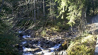
The violin Bach is a little longer than a kilometer left and southern tributary of the Great Gaißach in the natural area Tolz-Tegernsee-Chiemgau Flyschalpen belonging northern foothills of the western Mangfall mountains on the territory of the municipality Waakirchen in Upper Bavarian district of Miesbach .
The Geigenbach arises from the confluence of the Schreibbach and a cluster of ditches on the northern slopes of the Gronetseck .
Individual evidence
- ↑ a b BayernAtlas of the Bavarian State Government ( notes )
- ↑ Hansjörg Dongus : Geographical land survey: The natural space units on sheet 189/195 Tegernsee. Federal Institute for Regional Studies, Bad Godesberg 1994. → Online map (PDF; 5.2 MB)
