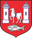
Gmina Kock
| Gmina Kock | ||
|---|---|---|

|
|
|
| Basic data | ||
| State : | Poland | |
| Voivodeship : | Lublin | |
| Powiat : | Lubartowski | |
| Geographic location : | 51 ° 38 ' N , 22 ° 27' E | |
| Residents : | s. Gmina | |
| Postal code : | 21-150 | |
| Telephone code : | (+48) 81 | |
| License plate : | LLB | |
| Economy and Transport | ||
| Street : | DK19 | |
| DK48 | ||
| Gmina | ||
| Gminatype: | Urban-and-rural parish | |
| Surface: | 100.62 km² | |
| Residents: | 6400 (Jun. 30, 2019) |
|
| Population density : | 64 inhabitants / km² | |
| Community number ( GUS ): | 0608063 | |
| Administration (as of 2013) | ||
| Mayor : | Tomasz Futera | |
| Address: | ul. Krasickiego 27 21-150 Kock |
|
| Website : | www.kock.pl | |
The Gmina Kock is an urban-and-rural municipality in the Lubartowski powiat in the Lublin Voivodeship in Poland . Its seat is the city of the same name ( German Kotzk ).
geography
The municipality is located about 40 km north of Lublin and about 120 km southeast of Warsaw on the edge of the Pradolina Wieprza and Równina Łukowska plateau. It has an area of 100.62 km². 71% of the area is used for agriculture, 17% is covered with forest. The Czarna River flows into the Tyśmienica in the municipality
history
Gmina Kock was formed in 1973 and from 1975 to 1998 it belonged to the smaller Lublin Voivodeship .
structure
The following villages belong to the urban and rural community (gmina miejsko-wiejska) Kock (the number in brackets indicates the number of inhabitants) :
Annopol (220), Annówka (85), Białobrzegi (390), Białobrzegi-Kolonia, Bożniewice (130), Górka (664), Lipniak (100), Poizdów (371), Poizdów-Kolonia, Ruska Wieś (165), Talczyn (707), Talczyn-Kolonia, Wygnanka (144) and Zakalew (153). Some of these are the seat of a Sołectwo (Schulzenamt) .
education
Gmina Kock has a kindergarten (przedszkole), five primary schools (szkoła podstawowa), two middle schools (gimnazjum) and a general high school with technical vocational training (Liceum ogólnokształcące i Technikum).
Web links
Footnotes
- ↑ population. Size and Structure by Territorial Division. As of June 30, 2019. Główny Urząd Statystyczny (GUS) (PDF files; 0.99 MiB), accessed December 24, 2019 .
- ↑ regioset.pl (Polish / English accessed on October 2, 2011)
- ↑ Dz.U. 1975 no 17 poz. 92 (Polish) (PDF; 802 kB)
- ↑ Mapa.Szukacz.pl (accessed in Polish on October 2, 2011)
