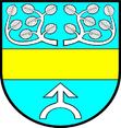
Gmina Obrowo
| Gmina Obrowo | ||
|---|---|---|

|
|
|
| Basic data | ||
| State : | Poland | |
| Voivodeship : | Kuyavian Pomeranian | |
| Powiat : | Toruński | |
| Geographic location : | 52 ° 58 ' N , 18 ° 53' E | |
| Height : | 89 m npm | |
| Residents : | see Gmina | |
| Postal code : | 87-148 | |
| Telephone code : | (+48) 56 | |
| License plate : | CTR | |
| Gmina | ||
| Gminatype: | Rural community | |
| Gmina structure: | 21 school authorities | |
| Surface: | 161.97 km² | |
| Residents: | 17,486 (Jun. 30, 2019) |
|
| Population density : | 108 inhabitants / km² | |
| Community number ( GUS ): | 0415072 | |
| administration | ||
| Community leader : | Andrzej Wieczyński | |
| Website : | www.obrowo.pl | |
The Gmina Obrowo is a rural community in the Powiat Toruński of the Kuyavian-Pomeranian Voivodeship in Poland . Its seat is the village of the same name ( German 1942–1945 Obrau ) with about 1400 inhabitants.
structure
The rural community Obrowo includes 21 villages (German names until 1945) with a Schulzenamt:
|
|
|
Another place in the municipality is Łęk-Osiek ( 1940–1942 Leng-Osiek , 1942–1945 Lengden , older also Osieker Lengden ).
Web links
- District of Czernikowo / Schwarzendorf (1939–1945)
- List of places in the district of Lipno / Leipe (West Pr.)
Footnotes
- ↑ population. Size and Structure by Territorial Division. As of June 30, 2019. Główny Urząd Statystyczny (GUS) (PDF files; 0.99 MiB), accessed December 24, 2019 .
- ↑ a b c d e f See the district of Czernikowo / Schwarzendorf , community renaming (1942)
- ↑ http://www.thorn-wpr.de/fqRHHoll.htm
- ↑ http://upstreamvistula.org/Parishes/Ossowka_D.htm
