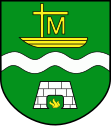
Gmina Płaska
| Gmina Płaska | ||
|---|---|---|

|
|
|
| Basic data | ||
| State : | Poland | |
| Voivodeship : | Podlaskie | |
| Powiat : | Augustowski | |
| Geographic location : | 53 ° 54 ' N , 23 ° 15' E | |
| Residents : | see Gmina | |
| Postal code : | 16-326 | |
| Telephone code : | (+48) 87 | |
| License plate : | CONSTRUCTION | |
| Gmina | ||
| Gminatype: | Rural community | |
| Gmina structure: | 15 school offices | |
| Surface: | 373.19 km² | |
| Residents: | 2594 (June 30, 2019) |
|
| Population density : | 7 inhabitants / km² | |
| Community number ( GUS ): | 2001062 | |
| Administration (as of 2006) | ||
| Community leader : | Wiesław Gołaszewski | |
| Website : | www.plaska.pl | |
The Gmina Płaska ( Lithuanian Plaskų valsčius ) is a rural municipality in the Powiat Augustowski of the Podlaskie Voivodeship in Poland . Their seat is the village of the same name .
structure
The rural community of Płaska has 15 districts with a Schulzenamt:
- Dalny Las
- Gorczyca
- Gruszki
- Macharce
- Mikaszówka
- Mołowiste
- Płaska
- Podmacharce
- Rubcowo
- Rudawka
- Rygol
- Serski Las
- Serwy
- Strzelcowizna
- Sucha Rzeczka
Other localities in the municipality are:
- Hanus (gajówka)
- Hanus (leśniczówka)
- Jazy
- Jałowy Róg
- Kielmin
- Kopanica
- Księży Mostek
- Kudrynki
- Lipiny
- Lubinowo
- Mały Borek
- Muły
- Osienniki
- Ostryńskie
- Perkuć
- Przewięź
- Tartak
- Trzy Kopce
Footnotes
- ↑ population. Size and Structure by Territorial Division. As of June 30, 2019. Główny Urząd Statystyczny (GUS) (PDF files; 0.99 MiB), accessed December 24, 2019 .
