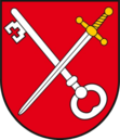
Gmina Tarnawatka
| Gmina Tarnawatka | ||
|---|---|---|

|
|
|
| Basic data | ||
| State : | Poland | |
| Voivodeship : | Lublin | |
| Powiat : | Tomaszowski | |
| Geographic location : | 50 ° 32 ' N , 23 ° 23' E | |
| Residents : | see Gmina | |
| Postal code : | 22-604 | |
| Telephone code : | (+48) 84 | |
| License plate : | LTM | |
| Economy and Transport | ||
| Street : | S17 , DK17 | |
| Gmina | ||
| Gminatype: | Rural community | |
| Surface: | 82.66 km² | |
| Residents: | 3922 (June 30, 2019) |
|
| Population density : | 47 inhabitants / km² | |
| Community number ( GUS ): | 0618092 | |
| Address: | ul.Lubelska 39 22-604 Tarnawatka |
|
The Gmina Tarnawatka is a rural community in the powiat Tomaszowski of the Lublin Voivodeship in Poland . Its seat is the village of the same name with 970 inhabitants (2010).
structure
The following localities with a Schulzenamt belong to the rural community of Tarnawatka :
- Dąbrowa Tarnawacka
- Huta Tarnawacka
- Klocówka
- Kunówka
- Niemirówek
- Niemirówek-Kolonia
- Pańków
- Pauczne
- Podhucie
- Sumin
- Tarnawatka
- Tarnawatka tartak
- Wieprzów Ordynacki
- Wieprzów Tarnawacki
Other places in the municipality are:
- Górka
- Gromada
- Hatczyska
- Hatczyska-Kolonia
- Kaliszaki
- Kocia Wólka
- Kolonia Klocówka
- Łanowe Sołtysy
- Petrynówka
- Pucharki
- Skrzypny Ostrów
- Suminek
- Tarnawatka
- Zaolzie
Individual evidence
- ↑ population. Size and Structure by Territorial Division. As of June 30, 2019. Główny Urząd Statystyczny (GUS) (PDF files; 0.99 MiB), accessed December 24, 2019 .
