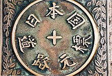
Gokaidō
The Gokaidō ( Japanese 五 街道 ) were the five main streets ( kaidō ) of the Edo period . They all started in Edo , what is now Tokyo . The most important of the five was the Tōkaidō , which linked Edo with Kyōto . Tokugawa Ieyasu initiated the construction of the Gokaidō in 1601 to increase his control over the country. But it was Tokugawa Ietsuna , the fourth shogun of the Tokugawa shogunate and great-grandson of Ieyasu, who turned the streets into main streets. There were many shukuba on the routes, Post Stations, which offered travelers shelter and the opportunity to replenish their supplies.
The five main streets
Each of the five streets began in Nihonbashi in Edo and connected the capital to another part of the country.
- Tōkaidō (Route E on the picture)
- The coastal Tōkaidō had 53 rest stops and connected Edo with Kyōto. From Kusatsu-juku he shared the road with the Nakasendō.
- Nakasendō (Route D on the picture)
- On the Nakasendō (also called Kiso Kaidō) there were 69 rest stops. He also connected Edo with Kyōto, but led through the center of Honshū and ended in Kusatsu in the Tōkaidō.
- Kōshū Kaidō (Route C on the picture)
- The Kōshū Kaidō had 44 rest stops and served as a connection to Kai Province ( Yamanashi Prefecture ). It ended in Shimosuwa-shuku , which was on the Nakasendō.
- Ōshū Kaidō (Route A on the picture)
- The Ōshū Kaidō included 27 rest stops and linked Edo with the province of Mutsu ( Fukushima Prefecture ). Many secondary routes went from him to northern Japan.
- Nikkō Kaidō (On the picture route B)
- The Nikkō Kaidō had 21 rest stops and connected with Nikkō Tōshō-gū in what is now Tochigi Prefecture .
Other roads

In addition to the Gokaidō, there were other smaller or less frequented streets, which sometimes ran as an alternative to the main routes. They were also colloquially called hime kaidō (princess street) or onna kaidō (women’s street). The Nakasendō was also sometimes referred to as the hime kaidō because it was considered less dangerous than the Tōkaidō, which had the same start and end point.
- Aizu Nishi Kaidō
- Bungo Kaidō
- Chichibu Ōkan
- Hokkoku Kaidō
- Hokurikudō
- Kawagoe Kaidō
- Kawagoe Kodama Kaidō
- Kamakura Kaidō
- Kōya Kaidō
- Kyōkaidō
- Matsumaedō
- Mikuni Kaidō
- Minoji
- Mito Kaidō
- Nagasaki Kaidō
- Nikkō Onari Kaidō
- Nikkō Reiheishi Kaidō
- Nikkō Wakiōkan
- Ōyama Kaidō
- Saigoku Kaidō
- Satsuma Kaidō
- Sendaidō
- Shio no Michi
- Tōgane Onari Kaidō
- Tosa Kaidō
- Ushū Kaidō
- Yamato no Kodō
See also
Individual evidence
- ↑ WebJapan Atlas: Nakasendo . Accessed August 2, 2007.
- ↑ Yumekaidō: Kōshū Kaidō Map ( Memento of the original from April 2, 2009 in the Internet Archive ) Info: The archive link was inserted automatically and has not yet been checked. Please check the original and archive link according to the instructions and then remove this notice. . Accessed September 4, 2007.
- ↑ Yumekaidō: Ōshū Kaidō Map ( Memento of the original from April 16, 2009 in the Internet Archive ) Info: The archive link was inserted automatically and has not yet been checked. Please check the original and archive link according to the instructions and then remove this notice. . Accessed September 4, 2007.
- ↑ www.ikedakai.com (accessed August 15, 2007) ( Memento from September 28, 2007 in the Internet Archive ).
- ↑ Nagasaki Kaidō ( Memento of the original from April 8, 2008 in the Internet Archive ) Info: The archive link was automatically inserted and has not yet been checked. Please check the original and archive link according to the instructions and then remove this notice. . Nagasaki Prefecture. Accessed March 12, 2008.


