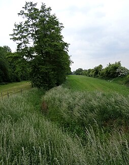
Goldbach (Selz)
| Goldbach | ||
| Data | ||
| Water code | DE : 252552 | |
| location | Rheinhessen , Rhineland-Palatinate , Germany | |
| River system | Rhine | |
| Drain over | Selz → Rhine → North Sea | |
| source | Northwest of Gabsheim 49 ° 50 ′ 13 ″ N , 8 ° 9 ′ 3 ″ E |
|
| Source height | approx. 207 m above sea level NN | |
| muzzle | At Koengernheim in the Selz coordinates: 49 ° 50 '39 " N , 8 ° 14' 42" E 49 ° 50 '39 " N , 8 ° 14' 42" E |
|
| Mouth height | approx. 124 m above sea level NN | |
| Height difference | approx. 83 m | |
| Bottom slope | approx. 13 ‰ | |
| length | 6.2 km | |
| Catchment area | 14.849 km² | |
The Goldbach is a 6 km long tributary of the Selz in Rheinhessen .
course
The Goldbach rises in a water protection area on the federal motorway 63 , above Gabsheim (southeast of the intersection A63 / B420). After crossing under the L430 road, it is fed on its right by the 1.7 km long Gelbfelder Bach . On the outskirts of Undenheim, the approximately 5.5 km long Nordelsheimer Bach flows into it from the right . After flowing through Undenheim, the Goldbach flows into the Selz on the edge of a new development area of Köngernheim near the federal highway 420 .
Individual evidence
- ↑ a b Topographic map 1: 25,000
- ↑ a b Rhineland Water Management Administration
