
Gottruple
|
Gottruple
Coordinates: 54 ° 46 ′ 34 ″ N , 9 ° 21 ′ 22 ″ E
|
||
|---|---|---|
| Residents : | 259 (2010) | |
| Postal code : | 24983 | |
| Area code : | 04608 | |
Location of Gottrupel in Schleswig-Holstein |
||
 Signpost from Gottrupel
|
||

Gottrupel ( Danish : Gottrupelle ) is a village that largely belongs to Handewitt . A small part of the Stadtweg belongs to Flensburg - Friesischer Berg .
location

The village lies above the Handewitter village of Langberg and above the Bundesstrasse 199 coming from Flensburg , which separates the two villages. The Lecker Chaussee, which runs parallel to the B 199, serves as the access road to Gottrupel . The original village in the west is also separated from the eastern village area by the A7 . In the eastern part there are two more settlement centers today, one on the "Chaussee-Häuserzeile" with the Lecker Chaussee mentioned as well as the neighboring town path and the settlement center on the Gottrupelfeld on the Ihlseeweg.
In the north of the small village is the German-Danish border . In the direction of the town of Handewitt, near Gottrupel, there is the Scandinavia Park , a large shopping market which is located directly in the access area to Handewitt and which, to a large extent, also serves incoming customers from Denmark .
There are several small ponds and lakes near the village of Gottrupel. The Meyner Mühlenstrom flows along the village in the north . Another piece to the north is the village of Ellund, which today also belongs to Handewitt. The area is still sparsely populated today. To the east of Gottrupel, the entire Flensburg area, below the so-called Nonnenberg , a hill grave, is still undeveloped. The area above with the said mountain is the northern Harrisleer area of the foundation land .
history
_an_der_Stra%C3%9Fe_Meynautal.JPG)
Gottrupel was first mentioned in documents in the 15th century. The settlement name Gottrupel is based on the name components: "Gothi" (a personal name), "torp" (meaning village) and "elle" ( alder ). Gottrupel's place name obviously has the meaning: "Gothi's village in the alder tree".
In 1938, gravel mining began near Gottrupel. In the following decades, exploited gravel pits were turned into garbage dumps . In the last days of the war, a large number of the remaining Nazi leaders did not flee to an alleged Alpine fortress , but instead via the so-called Rattenlinie Nord to Flensburg. In Flensburg district Mürwik which was created special section Mürwik where the last imperial government under Karl Doenitz was staying. On March 11, 1946, the concentration camp commander of the Auschwitz concentration camp, Rudolf Höß, who had gone into hiding under a false name, was arrested by the British on a farm in the village of Gottrupel and extradited to Poland, where he was brought to justice and finally executed in Auschwitz. The coat he left behind is now in the collection of the Flensburg Museum .
In the 1960s, after the original village on the "Meyner Mühlenstrom" and next to the area on the "Chaussee-Häuserzeile", the third settlement core was built on the Gottrupelfeld. In 1963, Gottrupel farmers sold 100 hectares of the district to the Federal Property Office . Harrislee and Flensburg surrendered further adjacent areas to the Federal Property Office. In this way, a new large military training area was created at the Briesen barracks in Weiche. In 1967 the Gottrupel school was closed near the motorway bridge. Since then, the children have attended the village community school in Handewitt.
In the 1990s, the Briesen barracks in Weiche was closed. The Nature Conservation Foundation then acquired large parts of the military training area and designated the area as foundation land.
In 2011, the Gottrupel solar park was built near the B 199 . Today the gravel pits and garbage dumps in Gottrupel are closed. Nature has recaptured large areas of the area.
Individual evidence
- ↑ a b c d e f g h i j Gottrupel and the foundation country as in slumber , from: December 30, 2010; accessed on: January 9, 2016; (alternatively a copy there ( memento from March 4, 2016 in the Internet Archive ))
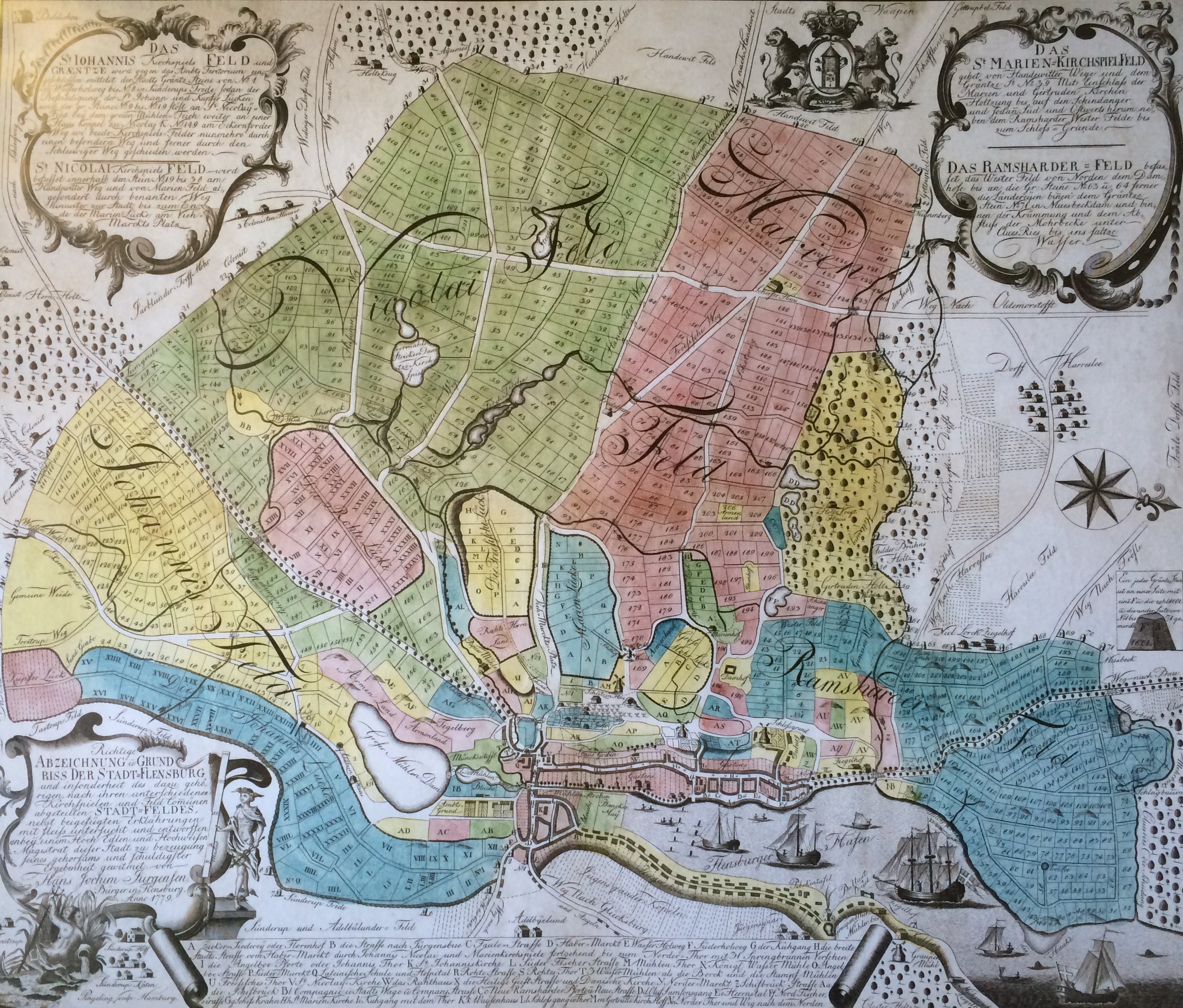
- ↑ The Gottrupel field is also already entered on the Jürgensen map of Flensburg and the surrounding area in 1779 .
- ↑ Stern : Flensburg rat line north. , dated: May 3, 2005; Retrieved on: January 23, 2016
- ↑ Flensburger Tageblatt : Bus tour through Flensburg: In the footsteps of contemporary history , from: January 30, 2012; Retrieved on: January 23, 2016
- ↑ sh: z : Auschwitz Commander in World War II: How Rudolf Höss was arrested in SH , from: October 5, 2014; Retrieved on: January 9, 2016
- ↑ sh: z : A concentration camp commandant complains - How the British tracked down Rudolf Höß , from: May 21, 2015; Retrieved on: January 9, 2016
- ↑ Der Spiegel : Nazi investigator Hanns Alexander. The man who hunted Rudolf Höß from: August 27, 2014; Retrieved on: January 9, 2016
- ↑ The area on the "Chaussee-Häuserzeile" (including the houses there on Stadtweg) is apparently rarely also called "At the source". See pilgrimage route. Ox path. Card 10
- ↑ Information sheet for the municipality of Handewitt Announcement sheet for the municipality of Handewitt ( Memento from January 3, 2016 in the Internet Archive ), No. 27, from: October 28, 2011