Grünbach (Ammer)
|
Grünbach Wühlbach |
||
|
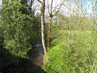
Grünbach (Brunnenbach) near Wilzhofen |
||
| Data | ||
| Water code | DE : 164314 | |
| location | Bavaria | |
| River system | Danube | |
| Drain over | Ammer → Isar → Danube → Black Sea | |
| source | at Seeshaupt 47 ° 48 ′ 41 ″ N , 11 ° 15 ′ 52 ″ E |
|
| Source height | approx. 627 m above sea level NHN | |
| muzzle | as Brunnenbach from the right in Wielenbach in the ampere -Oberlauf Bunting coordinates: 47 ° 53 '8 " N , 11 ° 8' 50" O 47 ° 53 '8 " N , 11 ° 8' 50" O |
|
| Mouth height | approx. 541 m above sea level NHN | |
| Height difference | approx. 86 m | |
| Bottom slope | approx. 5.7 ‰ | |
| length | approx. 15.1 km | |
| Right tributaries | Murnauer Bach , Hardtbach | |
The Grünbach or Wühlbach , in the lower reaches from Wielenbach to the confluence with the Ammer Brunnenbach , is a right tributary of the Ammer in the Upper Bavarian district of Weilheim-Schongau .
geography
The Grünbach rises near Seeshaupt and forms a diagonal from southeast to northwest through the Eberfinger Drumlinfeld .
Individual evidence
Web links
- Course of the Grünbach on the BayernAtlas
