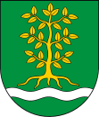
Grabów nad Pilicą
| Grabów nad Pilicą | ||
|---|---|---|

|
|
|
| Basic data | ||
| State : | Poland | |
| Voivodeship : | Mazovia | |
| Powiat : | Kozienicki | |
| Geographic location : | 51 ° 43 ' N , 21 ° 14' E | |
| Residents : | see Gmina | |
| Postal code : | 26,902 | |
| Telephone code : | (+48) 48 | |
| License plate : | WKZ | |
| Economy and Transport | ||
| Street : | Droga wojewódzka 730 | |
| Rail route : | Warsaw – Radom | |
| Next international airport : | Warsaw | |
| Gmina | ||
| Gminatype: | Rural community | |
| Gmina structure: | 26 school offices | |
| Surface: | 124.66 km² | |
| Residents: | 3900 (Jun. 30, 2019) |
|
| Population density : | 31 inhabitants / km² | |
| Community number ( GUS ): | 1407042 | |
| administration | ||
| Mayor : | Eusebius Strzelczyk | |
| Address: | ul.Kazimierza Pułaskiego 51 26-902 Grabów nad Pilicą |
|
| Website : | www.grabow.pl | |
Grabów nad Pilicą is a village in the powiat Kozienicki in the Masovian Voivodeship , Poland . Grabów nad Pilicą is also the seat of the rural municipality of the same name ( gmina wiejska ).
geography
Grabów nad Pilicą is located 58 km south of Warsaw and 28 km northwest of the district town Kozienice and lies on the Pilica River .
history
The first mention of a settlement at this place comes from Casimir the Great in 1359. The name Grabów appears for the first time in 1569. After the third partition of Poland , the village became part of Austria . The border between Austria and Prussia ran along the Pilica River . A garrison building has survived from this time and today it houses the town hall. Over the centuries the village changed hands several times. During the Second World War the village was almost completely destroyed.
From 1975 to 1998 the municipality belonged to the Radom Voivodeship .
traffic
The Grabów nad Pilicą and Strzyżyna stops on the Warszawa – Kraków railway line are in the municipality .
Sons and daughters of the church
- Maria Komornicka , writer
Rural community
geography
The municipality has an area of 124.66 km². 54% of the municipal area is used for agriculture, 41% is covered with forest.
Sołectwo
The rural community includes 26 sołectwo ( school offices ):
- Augustów
- Broncin
- Brzozówka
- Budy Augustowskie
- Celinów
- Cychrowska Wola
- Czerwonka
- Dąbrówki
- Dziecinów
- Edwardów
- Grabina
- Grabowska Wola
- Grabów nad Pilicą
- Grabów Nowy
- Koziołek
- Lipinki
- Łękawica
- Małęczyn
- Nowa Wola
- Paprotnia
- Strzyżyna
- Tomczyn
- Utniki
- Wyborów
- Zakrzew
- Zwierzyniec
Other places in the municipality are Gajówka Czerwonka, Gajówka Paprotnia, Grabów, Grabów Zaleśny, Kukawka, Kępa Niemojewska, Kępa Niemojewska (leśniczówka) and Strzyżyna (leśniczówka).
Web links
Individual evidence
- ↑ population. Size and Structure by Territorial Division. As of June 30, 2019. Główny Urząd Statystyczny (GUS) (PDF files; 0.99 MiB), accessed December 24, 2019 .
- ^ History of Grabów nad Pilicą (accessed in Polish on October 21, 2010) ( Memento of the original from May 5, 2010 in the Internet Archive ) Info: The archive link has been inserted automatically and has not yet been checked. Please check the original and archive link according to the instructions and then remove this notice.
- ^ Website of the community
- ↑ Dz.U. 1975 no 17 poz. 92 (Polish) (PDF; 802 kB)
- ↑ regioset.pl (pl / en accessed October 21, 2010) ( Memento of the original from April 2, 2015 in the Internet Archive ) Info: The archive link was inserted automatically and has not yet been checked. Please check the original and archive link according to the instructions and then remove this notice.
