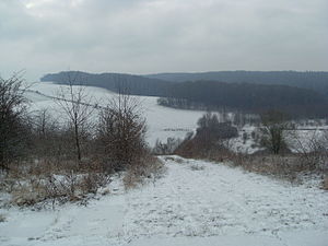
Border strip between Teistungen and Ecklingerode
|
Border strip between Teistungen and Ecklingerode
|
||
|
View from the northern Klosterberg over the Lindenbeek valley towards the Duderstädter Wald |
||
| location | Eichsfeld district , Thuringia | |
| surface | 147.7 ha | |
| WDPA ID | 318461 | |
| Geographical location | 51 ° 29 ' N , 10 ° 18' E | |
|
|
||
| Setup date | 2000 | |
| administration | Eichsfeld district | |
The border strip between Teistungen and Ecklingerode is a nature reserve in the Eichsfeld district in Thuringia in the border area with southern Lower Saxony . It extends over parts of the communities Teistungen , Wehnde and Ecklingerode .
Geographical location
The 147.1 hectare area in Unter eichsfeld consists of a 7.8 km long and 80 to 250 m wide strip of land along the former inner-German border ; A forest area is also included to the northwest of Wehnde. The nature reserve is part of the Green Belt and lies between the towns of Teistungen and Gerblingerode in the Hahletal and Ecklingerode and Fuhrbach in the northern Thuringian red sandstone region . According to the handbook of the natural spatial structure of Germany , the area belongs to the Eichsfeld basin .
The hilly terrain is traversed by smaller streams, such as the Lindenbeek and the Brehme , which flow into the Hahle in Duderstadt . Larger elevations are the Nonnecke (338.5 m), the Bundsenberg (up to 310 m), the Thomasberg (approx. 270 m) and the Klosterberg (up to 260 m).
At Ecklingerode there is the west-east gate in memory of the former border.
Nature reserve
The Wulfertal as a larger part of the nature reserve is occupied by mixed deciduous forest, mainly grove and woodruff beech forest. There are also spruce and spruce-larch forests as well as birch pioneer forests. In addition to the beech forests with a high proportion of dead wood, the open land biotopes along the former border, in which eu- and mesotrophic fresh and wet grassland alternate with more water -logged areas, are of particular importance .
See also
Web links
- West-East Gate
- Nature reserves (status: 03/2018) in the Eichsfeld district on tlug-jena.de, accessed on March 24, 2019
Individual evidence
-
↑ Various authors: Geographical Land Survey: The natural space units in single sheets 1: 200,000 - Federal Institute for Regional Studies, Bad Godesberg 1959–1970 → Online maps
- Sheet 99: Göttingen (Jürgen Hövermann 1963)
- Sheet 112: Kassel (H.-J. Klink 1969)
- ↑ Map services of the Federal Agency for Nature Conservation ( information )
- ↑ Nature reserves in the Eichsfeld district. Thuringian State Institute for Environment and Geology (TLUG), 2009, accessed on November 4, 2013 .


