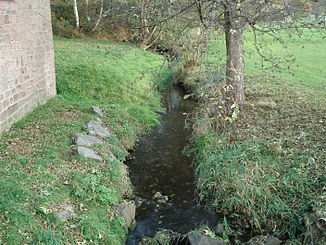
Grimmenwiesenbach
| Grimmenwiesenbach | ||
|
The Grimmenwiesenbach in Neuhütten |
||
| Data | ||
| Water code | DE : 2452224 | |
| location |
Spessart
|
|
| River system | Rhine | |
| Drain over | Lohrbach → Aubach → Lohr → Main → Rhine → North Sea | |
| origin | Confluence of the Outer Bach and Schwarzengrundbach 50 ° 0 ′ 13 ″ N , 9 ° 25 ′ 24 ″ E |
|
| Source height | 256 m above sea level NHN (at the confluence) | |
| muzzle | north of Neuhütten in the Lohrbach Coordinates: 50 ° 0 ′ 41 ″ N , 9 ° 24 ′ 58 ″ E 50 ° 0 ′ 41 ″ N , 9 ° 24 ′ 58 ″ E |
|
| Mouth height | 239 m above sea level NHN | |
| Height difference | 17 m | |
| Bottom slope | 15 ‰ | |
| length | 1.1 km from the confluence of 5.0 km with the Outer Bach |
|
| Catchment area | 11.8 km² | |
|
The Grimmenwiesenbach (front right) flows into the right arm of the Lohrbach |
||
The Grimmenwiesenbach is a right tributary of the Lohrbach in the Main-Spessart district in the Bavarian Spessart . It is created in Neuhütten by the confluence of the Outer Bach and Schwarzengrundbach .
geography
Spring streams
- Outer stream
The outer stream rises in the Stockbrunnen north of the Bischborner Hof , below the federal road 26 , in the forest Lohrerstraße . It flows in a northerly direction and is fed with additional water from the Gailsborn . The outer stream is the longer source stream at 3.9 km.
- Schwarzengrundbach
The source of the 3.0 km-long black-ground stream is north of Rothenbuch lying Black fountain in Rothbucher forest . It is reinforced by the fox fountain, passes the so-called source ford and joins the outer brook in Neuhütten.
course
After the confluence of the headwaters of the Grimm Wiesbachhorn flows through the built during the Village Renewal Grimmwiesensee . Before its completion, this place was used as arable land. At the Fleckensteinsmühle north of the village, the Grimmenwiesenbach passes under the state road 2317 ( Kahltal-Spessart cycle path ) and flows into the right arm of the Lohrbach .
Lohr river system
history
Mills
- Neumühle
- Fleckenstein mill


