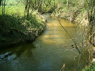
Big Gusen
| Big Gusen | ||
|
Große Gusen near Engerwitzdorf |
||
| Data | ||
| location | Mühlviertel , Upper Austria | |
| River system | Danube | |
| Drain over | Gusen → Danube → Black Sea | |
| origin | Confluence of several streams near Reichenau in the Mühlkreis 48 ° 27 ′ 9 ″ N , 14 ° 21 ′ 8 ″ E |
|
| Source height | approx. 650 m above sea level A. | |
| confluence | near Breitenbruck (municipality of Katsdorf ) with the Kleine Gusen zur Gusen Coordinates: 48 ° 19 ′ 39 ″ N , 14 ° 28 ′ 38 ″ E 48 ° 19 ′ 39 ″ N , 14 ° 28 ′ 38 ″ E |
|
| Mouth height | approx. 280 m above sea level A. | |
| Height difference | approx. 370 m | |
| Bottom slope | approx. 17 ‰ | |
| length | 22.3 km | |
| Discharge at the gauge Engerwitzdorf A Eo : 106.7 km² Location: 2.25 km above the mouth |
NNQ (07/15/1994) MNQ 1981–2011 MQ 1981–2011 Mq 1981–2011 MHQ 1981–2011 HHQ (08/13/2002) |
1 l / s 140 l / s 1.07 m³ / s 10 l / (s km²) 20.3 m³ / s 57.6 m³ / s |
| Right tributaries | Steinbach, Mirellenbach | |
| Small towns | Gallneukirchen | |
The Große Gusen is one of the two source rivers of the Gusen , a left tributary of the Danube in the Mühlviertel ( Upper Austria ). It is 22.3 km long, together with the Gusen it comes to a length of 39.8 km.
It is formed by the union of the Rohrbach with smaller brooks (including Grasbach) south of Reichenau in the Mühlkreis and flows through Gallneukirchen and Engerwitzdorf , the Gallneukirchen basin, in a south to south-east direction . This is where the Große Gusen and the Kleine Gusen come together and from now on is only called Gusen. A few kilometers after St. Georgen an der Gusen , the river flows into the Danube below the Danube power station Abhaben-Asten .
The Große Gusen has water quality class II throughout (as of 2007).
Web links
Individual evidence
- ↑ a b c d Digital Upper Austrian Room Information System (DORIS)
- ↑ Federal Ministry for Agriculture, Forestry, Environment and Water Management (Ed.): Hydrographisches Jahrbuch von Österreich 2011. 119th Volume. Vienna 2013, p. OG 187, PDF (12.9 MB) on bmlrt.gv.at (Yearbook 2011)
- ^ Office of Upper Austria. State government: water quality maps
