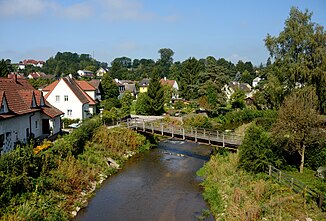
Gusen (river)
| Gusen | ||
|
Gusen in the center of St. Georgen |
||
| Data | ||
| location | Upper Austria | |
| River system | Danube | |
| Drain over | Danube → Black Sea | |
| origin |
Große Gusen ∞ Kleine Gusen near Katsdorf- Breitenbruck 48 ° 19 ′ 39 ″ N , 14 ° 28 ′ 38 ″ E |
|
| Source height | approx. 280 m above sea level A. | |
| muzzle | near Langenstein in the Danube Coordinates: 48 ° 14 ′ 44 ″ N , 14 ° 29 ′ 55 ″ E 48 ° 14 ′ 44 ″ N , 14 ° 29 ′ 55 ″ E |
|
| Mouth height | 245 m above sea level A. | |
| Height difference | approx. 35 m | |
| Bottom slope | approx. 2 ‰ | |
| length | 17.5 km | |
| Catchment area | 293.8 km² | |
| Discharge at the St. Georgen an der Gusen gauge (Bad) A Eo : 257.7 km² Location: 8.1 km above the mouth |
NNQ (09/06/2004) MNQ 1981–2011 MQ 1981–2011 Mq 1981–2011 MHQ 1981–2011 HHQ (08/08/2002) |
60 l / s 360 l / s 2.27 m³ / s 8.8 l / (s km²) 38.1 m³ / s 105 m³ / s |
| Left tributaries | Rieder Bach | |
| Communities | Katsdorf , St. Georgen an der Gusen , Langenstein , Mauthausen | |
The Gusen (from Germ. * Gusunō 'Guß') is a left-hand tributary of the Danube in the Mühlviertel in Upper Austria .
The Große Gusen and Kleine Gusen form the river Gusen from Katsdorf- Breitenbruck. Most of the Gallneukirchen basin is drained by the Gusen. From the Katsdorf district of Lungitz, the Gusen flows south to St. Georgen an der Gusen through the narrow Gusental. It flows into the Danube at Langenstein .
The Gusen is 17.5 km long, together with the Great Gusen, usually regarded as the upper reaches, it comes to a length of 39.8 km. The Gusen has water quality class II, shortly before the confluence with the Danube II to III (status 2007).
Gusengasse has been named after the river in Vienna since 1953 .
Web links
- Entry on Gusen in the Austria Forum (in the AEIOU Austria Lexicon )
Individual evidence
- ↑ a b c Digital Upper Austrian Room Information System (DORIS)
- ^ Office of the Upper Austrian provincial government (ed.): Kleine Gusen, Große Gusen and Gusen. Investigations on water quality, status 1992 - 1995 . Water protection report 13/1996, Linz 1996 ( PDF; 221.4 MB )
- ↑ Federal Ministry for Agriculture, Forestry, Environment and Water Management (Ed.): Hydrographisches Jahrbuch von Österreich 2011. 119th Volume. Vienna 2013, p. OG 188, PDF (12.9 MB) on bmlrt.gv.at (yearbook 2011)
- ^ Albrecht Greule: Layers of pre-German names in the German-speaking area . In: Werner Besch u. a. (Ed.): [HSK] History of Language. A handbook on the history of the German language and its research . 2nd Edition. 2nd subband. de Gruyter, 2004, p. 3467 .
- ^ Office of Upper Austria. State government: water quality maps
