Great Schwaberowsee
| Great Schwaberowsee | ||
|---|---|---|
| Geographical location | Oberhavel district | |
| Tributaries | from Kleiner Schwaberowsee from Sägersee |
|
| Drain | to the Thyme Lake | |
| Location close to the shore | Fürstenberg / Havel | |
| Data | ||
| Coordinates | 53 ° 14 '18 " N , 13 ° 7' 24" E | |
|
|
||
| Altitude above sea level | 52.1 m above sea level NHN | |
| surface | 31.2 ha | |
The Great Schwaberowsee is the second-lowest lake in the course of the Havel inflow to the GKZ 581,187 , in Mecklenburg-Vorpommern, Godendorfer Mühlebach 'and Brandenburg, Hegen stone Fliess's called. The natural lake is located in the natural area of the Neustrelitz Kleinseenland and in the Uckermärkische Seen nature park in the Oberhavel district ( Brandenburg ). It lies entirely within the boundaries of the core town of Fürstenberg / Havel .
Location and hydrography
Since the north bank of the Big Schwaberowsees part of the border MV / BB , the continuous wearing Havel inflow to the TVC or GWK 581,187 at the inlet of the name Godendorfer mill stream and as drain the name Hegenszenfließ .
The Große Schwaberowsee is about 6 km as the crow flies northwest of the core town of Fürstenberg / Havel. On the western bank, the federal highway 96 runs from Neustrelitz to Fürstenberg / Havel, on the northern bank the border with the state of Mecklenburg-Western Pomerania .
Its water level covers an area of 31 hectares. The body of water has an approximate length of 1.1 kilometers and an approximate width of about 400 meters. From the north there is a tributary from the Sägersee , in the west a connecting ditch from the Kleiner Schwaberowsee and another ditch flow into it . The Große Schwaberowsee flows to the southeast in the direction of Thymensee . The lake, together with the Thymensee and its surroundings, is part of the Thymen nature reserve . The lake shore is almost completely forested.
Between the lake and the federal highway 96 there is a drained meadow landscape with buttercups , forest cornices , swamp sedge and cuckoo herb . These original spring meadows on a moist eutrophic peat site are used as a horse paddock and threaten to dehumidify.

history
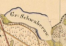
The lake was first mentioned in a document as early as 1299 ( stagnum Grote Zwagerou ). Along with 38 other lakes named above, it was part of the initial equipment of the Himmelpfort monastery . The monastery received from the Brandenburg margrave Albrecht III. the sole right of use over the lake. The meaning of the name is unclear, it is probably derived from a personal name. A place name derived from this personal name should have been transferred to the lake. In 1580 the lake was called Schwagerrow , in 1719 as Gr. Schwabero and on the Urmes table sheet of 1825 as Gr. Schwaberow . The lake belonged to the Ravensbrück community until 1950 .
Management
The lake is managed by the Krempig lake fishery.
Individual evidence
- ↑ Adolph Friedrich Johann Riedel : Codex Diplomaticus Brandenburgensis A. First main part or collection of documents on the history of spiritual foundations, noble families, as well as the towns and castles of the Mark Brandenburg, XIII. Band, Die Uckermark: Lychen, Zehdenik, Templin, Angermünde, Chorin Monastery; Uckermark documents. Reimer, Berlin 1857. (online at Google Books) p. 8.
- ↑ Reinhard E. Fischer (co-authors: Elzbieta Foster, Klaus Müller, Gerhard Schlimpert , Sophie Wauer, Cornelia Willich): Brandenburgisches Namenbuch. Part 10: The names of the waters of Brandenburg. Böhlau, Weimar 1996, ISBN 3-7400-1001-0 , p. 287.
- ↑ Water profile of the Großer Schwaberowsee on anglermap.de

