Gscheid (Black Forest)
| Gscheid | |||
|---|---|---|---|
|
Pass height |
|||
| Compass direction | west | east | |
| Pass height | 454 m above sea level NHN | ||
| Administrative district | Freiburg , Baden-Wuerttemberg , Germany | ||
| Watershed | Litzelwälderbächle → Brettenbach → Elz → Upper Rhine | Siegelbach → Elz → Upper Rhine | |
| Valley locations | Keppenbach | Gutach im Breisgau | |
| expansion | District road K 5109 | ||
| Mountains | Black Forest | ||
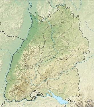
| Map (Baden-Württemberg) | |||
|
|
|||
| Coordinates | 48 ° 8 '18 " N , 7 ° 57' 24" E | ||
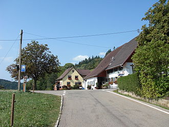
A pass height ( 454 m above sea level ) in the Black Forest between Keppenbach im Brettenbachtal and Gutach im Breisgau im Elztal is called Gscheid (also: Gescheid) .
The road is paved throughout and has almost two lanes.
Location and surroundings
Is of the municipality at the pass Freiamt belonging tines Gescheid. There is an Gasthof zum Gscheid at the top of the pass .
About 700 m north of the pass is the Tännlebühl ( 612 m above sea level ), about 1500 m southeast of the Walters Eckle ( 570 m above sea level ).
The top of the pass is on the Kandelhöhenweg and the Zweälersteig .
Web links
Individual evidence
- ↑ a b c Map services of the Federal Agency for Nature Conservation ( information )
- ↑ a b Wolfgang Abel: Time out in the green ( Memento of the original from October 4, 2010 in the Internet Archive ) Info: The archive link was automatically inserted and not yet checked. Please check the original and archive link according to the instructions and then remove this notice. (PDF; 15 kB) ( Badische Zeitung, "Streifzüge" column ( Memento of the original from October 4, 2010 in the Internet Archive ) Info: The archive link has been inserted automatically and has not yet been checked. Please check the original and archive link according to the instructions and then remove this notice. June 17, 2006)

