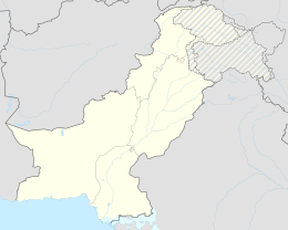
Gujranwala (District)
|
Gujranwala District ضِلع گُوجرانوالا |
||
| State : |
|
|
| Province : | Punjab | |
| Founded : | 1852 | |
| Seat : | Gujranwala | |
| Coordinates : | 32 ° 50 ′ N , 73 ° 10 ′ E | |
| Area : | 3 622 km² | |
| Residents : | 5,014,196 (2017) | |
| Population density : | 1,384 inhabitants per km² | |
| Time zone : | PST ( UTC + 5 ) | |
| Website : | ||
|
|
||
The Gujranwala District ( Punjabi and Urdu ضِلع گُوجرانوالا) is a district in Punjab Province , Pakistan .
history
Gujranwala belonged to the Majha region of the old Greater Punjab region . The village of Asarur was identified as the location of the village of Taki, which was founded by the Chinese Buddhist pilgrim Xuanzang ( 玄奘 ) in the 6th century BC. BC and has many Buddhist ruins. The village of Taki disappeared and Lahore became the provincial capital of Punjab. The current village of Asarur has been identified as the location of the ancient city. In the 7th century, Rajput kingdoms ruled the eastern parts of India and Pakistan. In the Mughal Empire , from Akbar I to Aurangzeb , the district flourished, there were numerous wells throughout the country and many villages were located in the southern plain, which is now overgrown with grass and hard-to-penetrate scrub. The remains can be found there to this day.
Eminabad and Hafizabad were the main cities in Gujranwala District. The whole country was divided into six pargans. However, the population decreased sharply towards the end of the Mughal rule for reasons that were not entirely clear and the region was repopulated by immigrant tribes. The most plausible explanation for this development are the wars waged in the last years of the Mughal Empire.
The Gujranwala district was occupied by Sikhs at the end of the Mughal Empire. Bhangi Misl was the first Sikh ruler to pillage Lahore and other cities in Punjab. Visitors who came to Lahore during this period reported that the city looked run down and was devastated by the Sikhs. Palaces and houses of the Muslims were confiscated by the Sikhs. Marble and precious stones from the Shalimar Gardens were stolen by the Sikhs to equip their own temples in Amritsar . Syed Ahmed Barelvi received numerous requests for help from Muslims in the Punjab. Muslims was adhan banned and the land of the Muslims was confiscated. Syed Ahmad Barelvi tried to raise funds and support in 1821 to rebuild Punjab. Muslims and Sikhs met in Okara in 1826 in a skirmish that ended in a draw. There was a battle between Sikhs and Muslims near Balakot in 1831, in which the Sikhs remained victorious. The Sikhs also began confiscating fields from the Muslims. The Sikhs settled in various cities in the district and took control of the Punjab province. Under Maharaja Ranjit Singh , Gujranwala was gradually rebuilt. In 1847 the British occupied the district and officially annexed it in 1849. The district was divided in 1852 between Gujranwala and Sialkot . The district stretched from the Chenab River to the Ravi River. During the Indian uprising in 1857 , Hindus and Sikhs sided with the government, while the Muslims supported the Mughal Empire. According to the 1901 census, the district had 890,577 inhabitants. Gujranwala District was part of the Lahore Division during the time of British India .
Demographics
The 1998 census showed a population of 3,400,940. The 2017 population was 5,014,196 (provisional data).
The most widely spoken language in Gujranwala District is Punjabi. According to the 1998 census, the literacy rate was 58% (63.6% for men, 48.8% for women). The literacy rate in the years 2014/15 among the population over 10 years of age was 71% (women: 69%, men: 74%) and is thus below the Punjab province average of 63%.
Infrastructure
Train connection
A train connection from Peshawar to Karachi crosses the Gujranwala district. The district is also connected by train connections with the cities of Sialkot, Hafizabad and Gujrat.
Individual evidence
- ↑ a b Gujrānwāla District . In: Imperial Gazetteer of India . tape 12 , 1908, pp. 355 (English, digitized version ).
- ↑ Gujrānwāla District . In: Imperial Gazetteer of India . tape 12 , 1908, pp. 353 (English, online ).
- ↑ a b District at a glance Gujranwala. Pakistani Bureau of Statistics, accessed November 11, 2018 .
- ↑ TABLE - 1: PROVISIONAL PROVINCE WISE POPULATION BY SEX AND RURAL / URBAN - CENSUS - 2017 PAKISTAN. Punjab Provincial Government, accessed November 11, 2018 .
- ↑ 1998 District Census report of Gujranwala (= Census publication), Volume 37. Population Census Organization, Statistics Division, Government of Pakistan, Islamabad 1999.
- ^ Pakistan Bureau of Statistics (2016). Pakistan Social and Living Standards Measurement Survey 2014-15. Government of Pakistan, accessed June 29, 2019 .
- ↑ Archived copy ( Memento of the original from April 22, 2008 in the Internet Archive ) Info: The archive link was inserted automatically and has not yet been checked. Please check the original and archive link according to the instructions and then remove this notice.
