Höllviken
| Höllviken and Ljunghusen | ||||
|
||||
| State : | Sweden | |||
| Province (län): | Skåne County | |||
| Historical Province (landskap): | Gentle | |||
| Municipality : | Vellinge | |||
| Coordinates : | 55 ° 25 ′ N , 12 ° 57 ′ E | |||
| SCB code : | 3496 | |||
| Status: | Crime scene | |||
| Residents : | 14,889 (December 31, 2015) | |||
| Area : | 13.01 km² | |||
| Population density : | 1144 inhabitants / km² | |||
| List of perpetrators in Skåne County | ||||
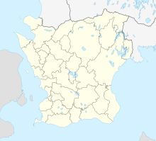
Höllviken is a place ( Tatort ) in the Swedish province of Skåne län and the historic province of Skåne . Höllviken is located in the municipality of Vellinge about six kilometers southwest of the main town of Vellinge .
The crime scene has been called Höllviken och Ljunghusen since 2015 after it actually merged with the neighboring, previously independent crime scene Ljunghusen (west towards Falsterbo) and Rängs sand (east, together 3363 inhabitants 2010).
Höllviken is located on the Falsterbo Canal , which cuts through the narrowest part of the Falsterbo peninsula . Länsväg 100 runs through the village and leads to Europaväg 6 , which runs past Vellinge and is built like a motorway, which leads as European route 6 to northern Norway.
The Viking Age Fotevikens Museum is north of the village . Höllviken's Kungshögen is located in the suburb of Stora Hammar
Daughters and sons
- Joakim Nilsson (* 1985), football player
- André Göransson (* 1994), tennis player
Web links
Individual evidence
- ↑ a b Statistiska centralbyrån : Land area per Tatort, folkmängd and invånare per square kilometer. Vart femte år 1960 - 2015 (database query)
