Hüllerup
|
Hüllerup
Handewitt parish
Coordinates: 54 ° 44 ′ 12 ″ N , 9 ° 20 ′ 39 ″ E
|
||
|---|---|---|
| Postal code : | 24983 | |
| Area code : | 04608 | |
|
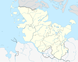
Location of Hüllerup in Schleswig-Holstein |
||
Hüllerup ( Danish : Hyllerup ) is a district of the municipality of Handewitt .
location
The village of Hüllerup is located south of the edge of the Handewitter Forest . It has a street-village-like shape, because it is mainly located on Bredstedter Straße, which runs from east to west. As the name of the street suggests, it is part of a 25-kilometer road connection that leads to the North Frisian town of Bredstedt . Neuholzkrug is about two kilometers east of the village of Hüllerup . Among other things, a forest path connects the two places. The neighboring village of Haurup is seven hundred meters south . To the north, beyond the forest, is the main town of Handewitt, three kilometers away. The main town of the municipality can be reached from the village of Hüllerup via Landstrasse 96 (L 96). The northeastern city of Flensburg is about three kilometers from the village of Hüllerup.
history
In the local guild directory from 1379–1509, the place was first mentioned under the name "Hwldorph". The prefix Hylle- goes back to Danish hyld for elderberry or possibly Old Norse hylr for a deep spot near a stream. The ending - rup of today's common place name is a synonym for a " village ".
Like the rest of Handewitt, Hüllerup did not belong to the Wiesharde , but to the Treiaharde . In 1557 there were four Hufen on Dorfstrasse in Hüllerup (i.e. on today's Alte Dorfstrasse ). Another was in Hüllerupfeld . The coupling was carried out in Hüllerup in 1798. In 1854 Hüllerup was added to the Flensburg office and was ultimately also assigned to the Wiesharde from that time. Hüllerup with its houses and farms could already be recognized on the land survey of the Scientific Society of Denmark from 1857/1858 used by the Danish General Staff and on the map of the Prussian land survey around 1879 . From 1956 to 1976 the land consolidation apparently took place . In the early 1960s, a development plan was drawn up and a phase of brisk construction activity began. By 1980, 70 new houses had been built in the village. In the course of the dissolution of the Flensburg-Land district in 1974, the previously independent municipality of Hüllerup was incorporated into Handewitt together with Ellund, Gottrupel, Haurup and Timmersiek.
Web links
- Handewitt parish , accessed on: July 12, 2020
Individual evidence
- ↑ Handewitt community development - compilation of projects , from: July 11, 2020
- ↑ Flensburger Tageblatt : Handewitt: Neuer Weg ins Erholungsgebiet , from: January 2, 2014; from: July 11, 2020
- ↑ Diplomattarium Flensburgensis Sejdelin Volume 1, Hwldorph. In: Municipality of Handewitt (ed.): Official Chronicle of Handewitt , Handewitt 2013, p. 665
- ↑ Wolfgang Laur: Historisches Ortsnamelexikon von Schleswig-Holstein , 2nd edition, Neumünster 1992, p. 351
- ↑ Anders Bjerrum: Sydslesvigs Stednavne , Vol. 4, 1979–1986, p. 520
- ↑ Johannes Kok: Det danske folkesprog i Sønderjylland , Vol. 2, Copenhagen 1867, p. 196
- ↑ Cf. also the word village with regard to the meaning of -rup: Danish : torp, Low German : Dbod, Dorp, English also: thorp (e); See Flensburg street names . Society for Flensburg City History, Flensburg 2005, article: Tremmerupweg and Wolfgang Lindow: Low German dictionary . Schuster, Leer 1998, article: Dorf and Judy Persall: The New Oxford Dictionary of English , 2001, article: thorpe
- ↑ Handewitt municipality (ed.): Official Chronicle Handewitt , Handewitt 2013, p. 665
- ^ General letters Videnskabernes Selskab Kaart over Slesvig, Vestre Blad (3). Copenhagen Royal Library.Retrieved July 11, 2020 .
- ↑ Prussian land survey around 1879 , accessed on: March 8, 2020
- ↑ Handewitt municipality (ed.): Official Chronicle Handewitt , Handewitt 2013, p. 665
