Haeju
| Haeju | |||
|---|---|---|---|
| Korean alphabet : | 해주시 | ||
| Chinese characters : | 海 州 | ||
| Revised Romanization : | Haeju-si | ||
| McCune-Reischauer : | Haeju-si | ||
| Basic data | |||
| Province : | Hwanghae-namdo | ||
| Coordinates : | 38 ° 3 ' N , 125 ° 43' E | ||
| Surface: | 206.9 km² | ||
| Residents: | 222,396 (as of January 1, 2005) | ||
| Population density : | 1,075 inhabitants per km² | ||
| map | |||
|
|||
Haeju is a city in North Korea with 222,396 inhabitants, a cultural center with a university , theater and museums . Haeju is the capital of Hwanghae-namdo Province .
geography
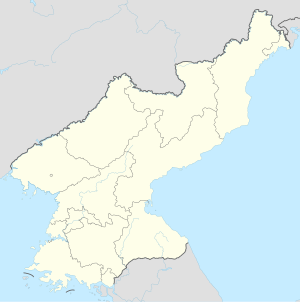
The city is located on the west coast of North Korea , 140 kilometers south of Pyongyang . The geographic coordinates are 38.04 degrees north and 125.71 degrees east.
history
Between 1910 and 1945, Korea and thus this city belonged to the Japanese Empire . Since Japanese was the national language at the time, the city name 海 州 was read in Japanese, Kaishū .
In 1938 Kaishū was officially granted city status.
Haeju suffered severe damage during the Korean War (1950 to 1953). After the war, the city developed into a center of industry and a transport hub in the region.
Culture and sights
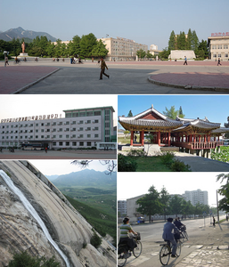
Seven and a half kilometers from the city is Mount Suyang, which is primarily worth a visit because of the waterfalls there. The water of Suyang flows over 128-meter-high and twelve-meter-wide cliffs into a picturesque little lake.
On the mountain itself an old fortification from the time of the Goryeo dynasty can be visited. In Haeju there is an old stone cold store, also from the time of the Koryo dynasty, and a five-story pagoda .
Nine kilometers southwest of Haeju on the coast, visitors can take a boat from the port, if available, to two rocky islands, the Hyongje Islands (brother islands). Their specialty is that when the tide is out, they leave behind a series of warm pools and a strip of sandy beach where you can swim.
The island of Sokdamgugok on the Sogdam River twelve kilometers north of Haeju also has to do with water . This beautiful island has rocks shaped differently by the water and swathed valleys. Because of the relaxing environment, a reading hall and a teaching house were set up in a beautiful natural garden on Sogdamgugok in the Joseon Dynasty , which can still be visited today.
Economy and Infrastructure
economy
Most of the cement and chemical industries have settled in the city.
traffic
Haeju is an important transportation hub ( road , rail , airport and port ). Mainly domestic flights start from the airport. B. to Ch'ŏngjin Airport .
sons and daughters of the town
- Jong Song-ok (* 1974), marathon runner.
- Rhee Syng-man , first President of South Korea
Climate table
| Haeju | ||||||||||||||||||||||||||||||||||||||||||||||||
|---|---|---|---|---|---|---|---|---|---|---|---|---|---|---|---|---|---|---|---|---|---|---|---|---|---|---|---|---|---|---|---|---|---|---|---|---|---|---|---|---|---|---|---|---|---|---|---|---|
| Climate diagram | ||||||||||||||||||||||||||||||||||||||||||||||||
| ||||||||||||||||||||||||||||||||||||||||||||||||
|
Average monthly temperatures and rainfall for Haeju
Source: wetterkontor.de
|
|||||||||||||||||||||||||||||||||||||||||||||||||||||||||||||||||||||||||||||||||||||||||||||||||||||||||||||||||||||||||||||||||||||||
Web links
- Rainer Dormels: Haeju - city with high development potential after reunification , 2014 (PDF; 511 kB)

