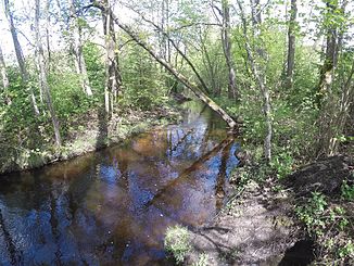
Hardtbach (Grünbach)
| Hardtbach | ||
|
Hardtbach near the hamlet of Gabler |
||
| Data | ||
| location | Bavaria | |
| River system | Danube | |
| Drain over | Grünbach → Ammer → Isar → Danube → Black Sea | |
| source |
Rothsee near Weilheim 47 ° 48 ′ 30 ″ N , 11 ° 13 ′ 27 ″ E |
|
| Source height | 645 m above sea level NHN | |
| muzzle | In front of Wielenbach from the left in the Grünbach coordinates: 47 ° 52 '35 " N , 11 ° 10' 14" E 47 ° 52 '35 " N , 11 ° 10' 14" E |
|
| Mouth height | approx. 554 m above sea level NHN | |
| Height difference | approx. 91 m | |
| Bottom slope | approx. 9.1 ‰ | |
| length | approx. 10 km | |
The Hardtbach is a left tributary of the Grünbach in the Upper Bavarian district of Weilheim-Schongau .
geography
The Hardtbach arises as the outflow of the Rothsee near Weilheim in Upper Bavaria in the Eberfinger Drumlinfeld . It first flows through the Mitterlache , the Haarsee , the Weiher Gumpenau and finally flows into the Grünbach after about a north-northwest run.
Web links
- Run of the Hardtbach on the BayernAtlas
