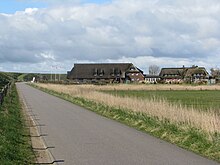
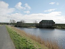
Hattstedter Neuer Koog
The Hattstedter Neue Koog (also called Nordkoog ) is a Koog within the North Frisian community Hattstedtermarsch in the district of North Friesland in the German state Schleswig-Holstein . It is the younger of the two original kings of the municipality, covers 374 hectares and was diked around 1500.
topography
The Hattstedter Neuer Koog is located in the middle of the North Frisian Marsch on the north-western edge of the historical administrative district of Südergoesharde . It is a little way off the North Frisian main traffic axis, the federal highway 5 . Halfway between Hattstedt and Struckum , a small country road branches off to the west, via which the Koog is reached after about 3.5 km. The Koog is very sparsely populated. Neighboring crags are (starting clockwise from the north):
- Desmerciereskoog
- Wallsbüller Saatkoog
- Hattstedter Alter Koog
- Beltringharder Koog
- Cecilienkoog
It is still one of the young marshes , but is counted here in the oldest category, the so-called Kleimarsch . The agricultural picture is determined by grassland farming.
history
After the dyke-up of the neighboring Hattstedter Alten Koog , a lot of sediment material was landed in front of the north-west corner, so that here too, the foreland that was ready for dyke was quickly created. As was customary at the time, the authority responsible for land reclamation was the sovereign, and that was Frederick I (Denmark and Norway) at the time . On his behalf and under contractually strictly regulated conditions, free and leased farmers carried out the dike. Details on this have not been handed down, only documentary records about later land sales in the said Koog allow conclusions for a completion at the latest in 1500.
Todays use
Today the Koog is mainly used for agriculture. The settlement function is very limited due to its location. According to building law, it is an outdoor area in which only privileged and other building projects are permitted. This includes, among other things, the construction of agricultural buildings and facilities that serve agricultural operations. Over time, only twelve individual settlements, some of which were built on terps , have emerged.
The small-scale economic structure is also shaped by tourism. The Hotel Arlau-Schleuse is located in the Koog directly on the dike to the Beltringharder Koog, which has been upstream since 1987 .
Much of the land in this area is dammed up meadows that were used as the Arlau water retention basin in front of the Arlau lock until the Beltringharder Koog with the Arlau reservoir was built. Today reed is partly grown in this area .
Web links
Individual evidence
- ^ Kunz, Harry and Albert Panten: Die Köge Nordfrieslands Nordfriisk Instituut , Bredstedt 1997, ISBN 3-88007-251-5 , p. 46
literature
- Kunz, Harry and Albert Panten: Die Köge Nordfrieslands Nordfriisk Instituut, Bredstedt 1997, ISBN 3-88007-251-5 , p. 46
- AG Chronik der Hattstedtermarsch: Chronik der Hattstedtermarsch Nordfriisk Instituut, Bredstedt / Bräist 1985, ISBN 3-88007-131-4
Coordinates: 54 ° 33 ′ 14 " N , 8 ° 57 ′ 11" E

