Cecilienkoog
|
Cecilienkoog
community Reußenköge
Coordinates: 54 ° 35 ′ 10 ″ N , 8 ° 55 ′ 35 ″ E
|
||
|---|---|---|
| Residents : | 61 (May 25 1987) | |
| Postal code : | 25821 | |
| Area code : | 04671 | |
|
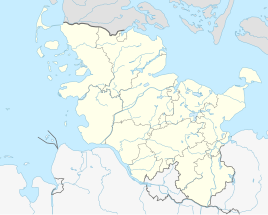
Location of Cecilienkoog in Schleswig-Holstein |
||
Cecilienkoog (Danish: Cecilie Kog , North Frisian: Cecilienkuuch ) is a populated part of the municipality of Reußenköge in Schleswig-Holstein. With an area of around 400 hectares, it is one of the smaller districts of the municipality. It was diked between 1903 and 1905 and is named after Cecilie von Mecklenburg-Schwerin . The dyke was financed roughly half by private parties and half by the public sector.
topography
The Cecilienkoog is located in the middle of the North Frisian March in central North Frisia. It is located at the southern end of the Reußenköge community, upstream of the Desmerciereskoog to the west. The access road (L 278) from the direction of Struckum turns north in the Cecilienkoog and continues from there to the neighboring Sönke-Nissen-Koog. The Koog is sparsely populated. The neighboring keds are:
| Sönke-Nissen-Koog | Reußenkoog | |
| Beltringharder Koog |

|
Sophien-Magdalenen-Koog |
| Hattstedter Neuer Koog | Desmerciereskoog |
Based on the date of the dike, it is counted among the Jungmarschen . The settlement structure corresponds to that of a scattered settlement . This consists largely of the farms that are still largely farmed.
history
Before the dike
After nothing more had happened in terms of land reclamation in the Bredstedt Bay after the Reußen- and Louisenkooges were dyed at the end of the 18th century, there was an increased landfall of sediment material in the southern area of the Bredstedt in the second half of the 19th century Bay. This landing was largely due to the favorable current conditions resulting from the construction of the dam to the Hamburg Hallig . The foreland, the areas of which used to be part of the Piek-, Meed- and Jakobshallig, were used as pastures even before the dike was built. In 1902, the imperial government finally gave the order to dike this area with a size of around 450 hectares.
Embankment
The embankment began in October 1903. Work on the new 4.5 km long dike was completed on July 12, 1905. A company from the north of Brandenburg (near Wilsnack ) was selected for the construction work .
A very critical situation had to be overcome on April 6, 1904, when a storm surge hit the North Sea coast. Even if there were no human lives to complain about, it was a major setback for the project.
Up to 400 workers were employed during the entire time of the dike. For the construction company, this project was a loss-making business, as the damage from the storm surge did not have to be borne by the client, the Husum domain rent and building authority , but by the construction company.
colonization
According to the financing, the Koog divided into a fiscal (state) part and one of the private interested parties. The latter comes from a joint purchase by local farmers in 1866 from the estate of the Hamburg shipowner and merchant Berend Roosen. The parcels of the fiscal part were auctioned at the highest bidder. The plots measured were between 2 and 8 hectares in size.
use
Agriculture
Agriculture was at the core of the economic structure from the start. Today five full-time businesses are still located in the Koog. Some lands are also cultivated by farmers from the neighboring arcs. The farms located in the Koog mostly operate arable farming in combination with pig farming . Some also offer holiday apartments. In recent years, photovoltaic systems have been installed on many farm buildings, which offer the companies another source of income.
Business
As a commercial enterprise, there is a project planning office for renewable energies in Cecilienkoog. In addition, a solar field has been set up in the Koog. In addition, 5 wind turbines and a biogas plant shape the image of the Kooges.
Statistical data on the Koog
The table below shows the population and households from the census of May 25, 1987, as these figures are only updated at community level in the following years.
|
Living - space - no. |
Koog | input deichung |
Area km² |
1987 census | |
|---|---|---|---|---|---|
| population | households | ||||
| 1 | Cecilienkoog | 1905 | 4.48 | 61 | 18th |
Web links
swell
- ↑ Reußenköge - Cecilienkoog
- ↑ Harry Kunz, Albert Panten: The Köge of North Friesland. Nordfriisk Instituut, Bredstedt 1997, ISBN 3-88007-251-5 , p. 44.
- ^ Sielverband Cecilienkoog (ed.): Der Cecilienkoog 1905–1980. Nordfriisk Instituut, Bredstedt 1980, ISBN 3-88007-086-5 , p. 23.
- ↑ a b Sielverband Cecilienkoog (ed.): Der Cecilienkoog 1905–1980. Nordfriisk Instituut, Bredstedt 1980, ISBN 3-88007-086-5 , p. 24f.
- ^ Sielverband Cecilienkoog (ed.): Der Cecilienkoog 1905–1980. Nordfriisk Instituut, Bredstedt 1980, ISBN 3-88007-086-5 , p. 32f.
literature
- Harry Kunz, Albert Panten: The Köge of North Frisia. Nordfriisk Instituut, Bredstedt 1997, ISBN 3-88007-251-5 , p. 44.
- Sielverband Cecilienkoog (ed.): The Cecilienkoog 1905–1980. Nordfriisk Instituut, Bredstedt 1980, ISBN 3-88007-086-5 .
- Sielverband Cecilienkoog (ed.): 100 years Cecilienkoog 1905–2005. Nordfriisk Instituut, Bredstedt 2005, ISBN 3-88007-086-5 .


