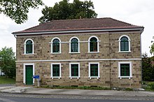
Hilpersdorf (desert)
Hilpersdorf (also Hildboldesdorf , Hilpoltsdorf ) is a medieval desert in the area of the independent city of Schweinfurt in Lower Franconia . The settlement was probably abandoned during the 17th century during the conflict in the Thirty Years' War .
Geographical location
The local desert is to be found in the west of the urban area, in the northwestern edge area of the former settlement Askren Manor . This was inhabited by Americans until the US military base in Schweinfurt was abandoned in 2014 and is currently (2018) under renovation. It has been called Bellevue since March 2018 and is located in the Musikerviertel district .
Even today, the settlement point is the corridor location Hilperskirche referred. The corridor is bounded to the west by the street Am Ochsenrasen , to the northwest by Euerbacher Straße and a small district that has been called Bellevue for about 100 years , to the east by Maple Street and to the south by a line 90 m north of Lee Street . The American street names have been renamed, and street layouts will also change as a result of the redevelopment of the district. Further to the northeast, the Willy Sachs Stadium and other sports facilities adjoin and the municipality of Niederwerrn begins 500 m northwest of the Hilperskirche corridor .
history
The place name with the ending -dorf refers to a relatively late foundation in the 8th or 9th century. The whole name can be interpreted as a settlement of Hiltpolt. At that time, the Frankish colonizers had already spread in the region . The village was probably initially part of the extensive Franconian royal estate and was given away to deserving nobles or monasteries in the 9th century. Hilpersdorf came to the Fulda Monastery , in whose possession it was first documented in 951.
Hilpersdorf appears again in the sources in 1094. At that time King Heinrich IV gave some estates and meadows to the newly founded Theres Monastery . The village "Hildboldesdorf" appeared among the donations. On June 29, 1282, Rudolf von Habsburg granted the city of Schweinfurt its own jurisdiction and ordered an exchange of goods between the Teutonic Order and the city. This also affected the property of the townspeople in Hilpersdorf.
In Hilpersdorf in 1313 there were several so-called Rodehuben , probably forest estates , of the Teutonic Order. Some of them were owned by Schweinfurt citizens . The Huben reappeared in a land register from 1337. At that time the village was called "Hilpoltsdorf". In the 14th century, the Hilpersdorf population began to move to the safe city of Schweinfurt. However, the village still existed.
In 1351 parts of the village were pledged by Johannes von Henneberg to the Würzburg prince-bishop Albrecht II von Hohenlohe . This gave the gradient in the new acquisition in 1359 to the Schweinfurt mayor. It was not until 1437 that the city of Schweinfurt was able to acquire the entire village. The district was dissolved and united with that of the city. Nevertheless, the village continued to exist as a dependent settlement complex.
As recently as 1476, the Würzburg monastery received some tithe levies from the village, so so-called chicken interest was collected. It was only during the Thirty Years' War and the frequent passage of enemy troops that the people of Hilpersdorf preferred to seek refuge behind the city's secure walls. Hilpersdorf was deserted by 1647 at the latest. The Hilpersdorfer settled in the Schweinfurt Bauerngasse and also brought their customs with them. The Hilpersdorfer Kirchweih in Schweinfurt was celebrated for a long time . In 1661 the ruins of the church disappeared as the last remnant. Underground remains of the village are classified by the Bavarian State Office for the Preservation of Monuments as a ground monument .
description
Large parts of the area of the Hilperskirche corridor are built over today and the four-lane Niederwerrner Strasse ( Bundesstrasse 303 ) runs not far north of the former settlement area. The corridor is on the flood-free eastern slope of the Werngrund . While the area west of the Wern, within the Wernbogen, is a flood plain . The desert is managed by the Bavarian State Office for the Preservation of Monuments as a ground monument D-6-5927-0004 settlement of linear ceramics and medieval desert "Hilpersdorf" (as of November 20, 2017).
Mills
The Wern still flows through the deserted site of Hilpersdorf today. Originally, at the Main inflow total of four mills on Hilpersdorfer district: the old mill still in parcel today Altmühl is narrated that Hildebuldesdorfer mill and the mule under the hus . The hallway at the Wernmühle has its origins in the mulen zu Werna . All Hilpersdorf mills are recorded in the interest book of the Teutonic Order from 1313.
See also
- Affeltrach
- Leinach (desert)
- Schmachtenberg (desert)
- Narrow field (desert)
- Senftenhof (desert)
- St. Kilian (desert)
literature
- Anton Oeller: The place names of the district of Schweinfurt (= Mainfränkische Studien 8) . Würzburg 1955.
- Peter Rückert: Land expansion and desertification of the high and late Middle Ages in the Franconian Gäuland. Diss . Wuerzburg 1990.
Individual evidence
- ^ Oeller, Anton: The place names of the district of Schweinfurt . P. 34.
- ^ Rückert, Peter: Land expansion and desertification of the high and late Middle Ages . P. 280 (list).
- ^ Rückert, Peter: Land expansion and desertification of the high and late Middle Ages . P. 198.
- ^ Oeller, Anton: The place names of the district of Schweinfurt . P. 34.
- ↑ Heimatbuch Oberwerrn, Part 1, Niederwerrn, 2006.
- ↑ Geodata Bavaria: Bodendenkmal D-6-5927-0008 , PDF file, accessed on August 3, 2017. P. 23.
- ↑ geodaten.bayern.de Monument List Schweinfurt. Retrieved November 24, 2017 .
- ^ Oeller, Anton: The place names of the district of Schweinfurt . P. 98.
Coordinates: 50 ° 3 ′ 1.5 ″ N , 10 ° 11 ′ 42.5 ″ E
