Hindaun
| Hindaun हिण्डौन सिटी |
||
|---|---|---|
|
|
||
| State : |
|
|
| State : | Rajasthan | |
| District : | Karauli | |
| Sub-district : | Hindaun | |
| Location : | 26 ° 44 ′ N , 77 ° 2 ′ E | |
| Height : | 234 m | |
| Area : | 48 km² | |
| Residents : | 105,452 (2011) | |
| Population density : | 2197 inhabitants / km² | |
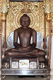
| Hindaun - Mahavira Jain Temple | ||
Hindaun or Hindaun City ( Hindi : हिण्डौन सिटी) is a north Indian city with about 110,000 inhabitants in the Karauli district in eastern Rajasthan .
location
Hindaun is located about 65 km (driving distance) southwest of Bharatpur and about 160 km east of Jaipur on the eastern edge of the Aravalli Mountains at an altitude of about 234 m above sea level. d. M. The climate is rather dry and warm; Rain falls almost exclusively during the summer monsoon season .
population
Official population statistics have only been kept and published since 1991.
| year | 1991 | 2001 | 2011 |
| Residents | 60,780 | 84,861 | 105,452 |
The Hindi and Urdu- speaking population consists of approximately 80.5% Hindus , 17.3% Muslims and 1.8% Jains ; numerically small minorities are Christians , Sikhs , Buddhists and others. As is customary in censuses in northern India, the male population is about 12% higher than the female.
economy
Traditionally, the basis of life is agriculture in the surrounding villages; The mining of red sandstone also gives many people work and bread. Craftsmen, traders and service companies of all kinds have settled in the city. Tourism only plays a subordinate role.
history
Hindaun's history goes back a long way; some believe that the place belonged to the Matsya kingdom in Vedic times . Later he was part of the Gupta empire . As part of the Islamic campaigns of Mahmud of Ghaznis in the northwest of the Indian subcontinent, the city was conquered at the beginning of the 11th century. Later it came under the rule of the Sultanate of Delhi, founded in 1206 . During the Mughal rule , it belonged to the province of Agra . In the 18th century Hindaun came briefly under the rule of the Marathas and then the Jat - princely state of Bharatpur . After the Battle of Deeg (1804), the British took control of the princely state, which was incorporated into the state of Rajasthan in 1949 and dissolved in 1956.
Attractions
Despite the possibly long history of the place, Hindaun does not have any sights of great cultural or historical importance. However, numerous Hindu and Jain temples as well as smaller shrines underscore the religious significance of the city.
- In the suburb of Hindaun Block there is a step well ( baoli ) made of red sandstone with numerous stairs leading down to the water, which give the structure a prism-like appearance.
- Surroundings
- On the Utangan River , approx. 20 km southwest of the city ( 26 ° 41 ′ 44 ″ N , 76 ° 54 ′ 53 ″ E ), the Shri Mahavir Ji Temple , built between the 17th and 20th centuries, rises up the Mahavira , the 24th and is consecrated to the last Tirthankara of the denomination. It is an important pilgrimage site for members of Jainism , as its origin goes back to the (alleged) rediscovery of a cult image in the 17th century.
- On a pedestal in front of the temple rises an approx. 12 m high lantern-like honor column ( manastambha ) made of white marble .
- Only a few meters from the main temple are separate shrines for Shantinatha and Parshvanata .
Web links
- Hindaun, history - photo + information (English)


