Hochfügener Strasse
| Street in Austria | |
| Basic data | |
| Operator: | Municipality of Fügenberg |
| Start of the street: |
Pankrazberg ( 931 m above sea level ) ( 47 ° 20 ′ N , 11 ° 50 ′ E ) |
| End of street: |
Hochfügen ( 1481 m above sea level ) ( 47 ° 16 ′ N , 11 ° 47 ′ E ) |
| Overall length: | 10 km |
|
State : |
|
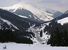
The Hochfügener Straße (also Hochfügenerstraße ) is a mountain road in the Tux Alps in Tyrol . It has its starting point in Pankrazberg in the northern Zillertal and leads to the Hochfügen hotel complex at an altitude of 1,480 meters . In doing so, it overcomes a difference in altitude of around 550 meters over a distance of around 10 kilometers.
Characteristic
The Hochfügener Straße begins in Pankrazberg as a continuation of the Pankrazbergstraße (L49). This begins on the Zillertalstraße on the southern outskirts of Fügen , first crosses the local area of Fügen and then climbs in serpentines to Pankrazberg. From there the road runs as Hochfügener Straße through the Finsingtal to Hochfügen. The road primarily serves as a feeder and supply road for the winter sports area . Therefore, it will also be cleared and kept free for traffic during the winter season. However, depending on the respective weather conditions, there may also be a risk of avalanches during this time.
history
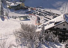
The construction of the Hochfügener Straße goes back to the tourist development of the Finsingtal . This development began when the foundation stone for the construction of the Berghotel Hochfügen was laid in the early 1960s . When the Hochfügen ski area developed around the resulting hotel village, the importance of the Hochfügener Straße grew, as it was the only access route to this ski area. However, since the Hochfügen-Hochzillertal ski area was connected to that of the neighboring Hochzillertal with new lifts in 2004 , this development has been reversed. Since then, the majority of skiers have been using the Hochzillertalbahn , which begins in Kaltenbach , to get to this ski area. Furthermore, in the winter season shuttle buses run regularly and several times a day between the surrounding communities and the Hochfügen ski area. However, the Hochfügener Straße has now also gained a greater role during the summer months, for example in the summer of 2008 it formed the final section of the queen stage of the Germany Tour .
literature
- Rudolf Geser: Alpine passes and mountain roads by bike: the 75 most beautiful tour suggestions , BLV Verlagsgesellschaft mbH, Munich 1992. ISBN 3405134528
- Eduard Denzel, Denzel combination guide auto + hiking shoe, Volume 4: North Tyrol , Verlag Harald Denzel KG, Innsbruck 1989. ISBN 3-85047-739-8
- Walter Klier : Zillertal, with Gerlos and Tuxer Tal , Bergverlag Rother , Munich 2008. ISBN 978-3-7633-4175-7
- Freytag & Berndt-Verlag Vienna, hiking map 1: 50,000, sheet WK 151, Zillertal, Tux Alps, Jenbach-Schwaz . ISBN 978-3-85084-751-3


