
Hochhauser Berg
| Hochhauser Berg | ||
|---|---|---|
 The Hochhauser Berg with the high-rise ruin. |
||
| height | 555 m above sea level NHN | |
| location | Bavaria , Germany | |
| Mountains | Swabian Alb | |
| Coordinates | 48 ° 47 '15 " N , 10 ° 29' 12" E | |
|
||

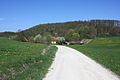
The Hochhauser Berg is 555.2 m above sea level. NHN high, fully forested mountain of the Riesalb , the eastern foothills of the Swabian Alb . The mountain lies in the Niederaltheim district of the Hohenaltheim community in the Donau-Ries district .
To the north, west and south of the mountain is surrounded by the Kartäusertal , in the east is the 539 m high Ganzenberg. The Karlshof domain is located at the southern foot of the mountain. The trout stream leaves the Kartäusertal at the northern foot of the mountain.
The mountain is best known for the ruins of Hochhaus Castle , an originally medieval hilltop castle on the west side of the mountain.
Numerous hiking trails lead past the mountain or over it, such as the Main-Danube-Weg and the Swabian-Alb-Nordrand-Weg .
The Hochhauser Berg from the south. In the foreground the Karlshof

Ruin of the high-rise castle
_von_S%C3%BCden.jpg)
