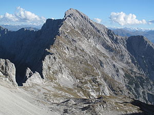
Hochnissl
| Hochnissl | ||
|---|---|---|
|
Hochnissl from the west (ascent to Lamsenspitze ) |
||
| height | 2547 m above sea level A. | |
| location | Tyrol , Austria | |
| Mountains | Hinterautal-Vomper chain , Karwendel | |
| Dominance | 3.6 km → high happiness | |
| Notch height | 367 m ↓ Lamsscharte | |
| Coordinates | 47 ° 22 '1 " N , 11 ° 37' 5" E | |
|
|
||
| rock | Wetterstein lime | |
| Age of the rock | Triassic ( Anisium to Carnian ) | |
| Normal way | From the Lamsenjochhütte via Lamsenscharte, posts I, insurance | |
|
Hochnissl from the southwest, left Rotwandlspitze ( 2322 m above sea level ), Steinkarlspitze ( 2460 m above sea level ), right Schneekopf ( 2313 m above sea level ), Mittagsspitze ( 2332 m above sea level ) |
||
The Hochnissl (also Hochnißl and Hochnißlspitze ) is 2547 m above sea level. A. high peak in the eastern Hinterautal-Vomper chain in the Karwendel . If the weather permits, it offers an excellent view, as it rises 2000 m above the Inn Valley .
An ascent via marked trails is currently (2018) only possible from Gasthof Karwendelrast ( 830 m above sea level ) on Vomperberg. The approach over the west ridge from the Lamsenscharte is closed for the foreseeable future due to the acute risk of landslides at the Steinkarlspitze. All other climbs, including over the 800 m high north face, are very seldom done.


