
Hochscheid (St. Ingbert)
| Hochscheid | ||
|---|---|---|
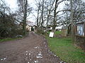
.jpg) cleared summit region |
||
| height | 400.8 m | |
| location | Saarland , Germany | |
| Mountains | Sankt Ingbert-Kirkeler forest area | |
| Coordinates | 49 ° 15 '24 " N , 7 ° 8' 32" E | |
|
||

The Hochscheid is a 400.8 m high elevation in the district of Hassel . It is located in the Sankt Ingbert-Kirkeler forest area .
To the west of Hochscheid is Reichenbrunn , to the south of Oberwürzbach and to the north-east of Hassel. It is separated from the urban area of St. Ingbert by the Rothenkopf . To the south, the entire area of the Hochscheid is bounded and drained by the valley of the Würzbach , and to the northeast by the valley of the Stockweiherbach . The demarcation to the northwest is less clear, the saddle to the Rothenkopf reaches a height of 355.2 m.
Farrenberg and Weidenberg are foothills of the Hochscheid to the south and southwest.
Historical monuments
On the Mittleren Kopf , between the Hochscheid and the Rothenkopf, remains of a wall can be found.
The Eichertsfels is located on the southern slope in the Laichweihertal .
In a forest valley to the north ( Schlossdell ), the remains of a hunting lodge can still be seen, which was built by a former owner of the village of Hassel, Baron von Esebeck, and destroyed by French revolutionary troops.
use
In contrast to most of the other elevations in this natural area, the summit has been cleared and is used for agriculture. The court Hochscheid is located just southwest of the highest point. Further to the east, on a foothill, the Glashütte mountain, there is another agricultural property , the Rittershof II . The Rittershof I is further down the valley on the L 111 between Hassel and Niederwürzbach .
The Hochscheid is located in a popular local recreation area that is accessed by a premium hiking trail.
photos
Hof Hochscheid

old stable at Rittershof II


Individual evidence
- ↑ Ludwig Petry (ed.): Handbook of the historical sites of Germany . Volume 5: Rhineland-Palatinate and Saarland (= Kröner's pocket edition . Volume 275). 3rd revised edition. Kröner, Stuttgart 1988, ISBN 3-520-27503-1 , p. 130.
- ↑ Hof Hochscheid , accessed on December 12, 2014.
- ↑ Saarpfalztouristik: Hüttenwanderweg accessed on February 6, 2019