Röllhausen
Coordinates: 50 ° 50 ′ 48 ″ N , 9 ° 19 ′ 36 ″ E
Röllhausen , also Hof Röllhausen , is a group of farmsteads in the district of Röllshausen , a district of the municipality of Schrecksbach in the Schwalm-Eder district in northern Hesse .
geography
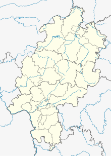
The small settlement is located on the eastern edge of the Schwalm or the western edge of the Knüll , 3.2 km southeast of Röllshausen at an altitude of 288 m in a narrow valley floor through which a brook flows in a south-north direction on the K 112 county road from Röllshausen to Wincherode about 200 m south of their intersection with the state road L 3156 from Schrecksbach to Neukirchen .
history
It was first mentioned as "Rulindenhusen" in 1231 in a document from the Breitenau monastery . Landowners in the small settlement in the 13th and 14th centuries were various aristocratic families from the area (including the von Spangenberg , von Löwenstein-Westerburg , and von Waldvogel ) and the monasteries Immichenhain and Haina . The last known documentary mention of the village as an inhabited place comes from 1393. In 1580 the place is described as desolate . Only five years later, three house seats are mentioned again. 1639, in the Thirty Years War there are only two left. Both in 1681 and 1747 there were four house seats or courtyards, and finally in 1885 there were six houses with 33 residents in the small town.
Footnotes
- ↑ Later written forms of the place name were Ruildehusen, Ruldehusen, Rulnhusen, Rolhausen ( Röllhausen, Schwalm-Eder-Kreis. Historical local dictionary for Hesse. (Status: 23 May 2018). In: Landesgeschichtliches Informationssystem Hessen (LAGIS).) And in the 19th . Century also Rühlhausen ( Handbook about the Kingdom of Westphalia , Hemmerde and Schwetschke, Halle, 1808, p. 293 ; JDA Höck (edit.): Statistics and Topography of the Electorate of Hesse ... , Jäger, Frankfurt, 1822, p. 152 ).
Web links
- Röllhausen, Schwalm-Eder district. Historical local dictionary for Hessen. In: Landesgeschichtliches Informationssystem Hessen (LAGIS).
