High Root (Hunsrück)
| High root | ||
|---|---|---|
|
Roaster head (left) and high root (right) |
||
| height | 669 m | |
| location | Rhineland-Palatinate , Germany | |
| Mountains | Osburger Hochwald , Hunsrück | |
| Dominance | 3.3 km → Rösterkopf | |
| Notch height | 89 m ↓ saddle to the Rösterkopf at approx. 580 m | |
| Coordinates | 49 ° 42 '17 " N , 6 ° 51' 45" E | |
|
|
||
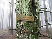
The High root is 669 m , the second highest elevation of Osburger forest in the Hunsrück in Rhineland-Palatinate . It is located in the Beuren district (Hochwald) .
The area belongs to the state forest (Landesforsten Rheinland-Pfalz).
Appearance
The Hohe Wurzel is more of an elongated ridge than a prominent mountain; in addition to the higher roaster head, it looks like its northeastern foothills. What is striking is the high-voltage overhead line between the Uchtelfangen and Niederstedem substations, which crosses the Hohe Wurzel almost centrally in a forest aisle .
traffic
The mountain is passed on its east side by the A1 north of junction 132 Reinsfeld . The developed state road L 151 runs over the southern flank from Hermeskeil to Trier .
tourism
The summit is forested and is not an attraction. The large circular hiking trail of the Saar-Hunsrück Nature Park includes the mountain and passes it to the southeast and northwest. The local hiking trail “Osburger Hochwald” runs over the summit section.


